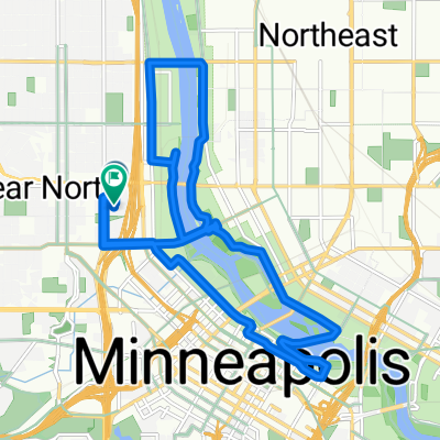
TCAC-Nokomis
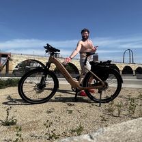
A cycling route starting in Minneapolis, Minnesota, United States.
Overview
About this route
6 miles from Hiawatha Collegiate High School to Lake Nokomis (4.1 to Minnehaha Falls and 1.9 from the falls to Nokomis). Â
2.9 miles to do a lap of the lake.
6 miles to ruturn by the same route
14.9 miles total
- -:--
- Duration
- 14.3 km
- Distance
- 46 m
- Ascent
- 51 m
- Descent
- ---
- Avg. speed
- 255 m
- Max. altitude
Route quality
Waytypes & surfaces along the route
Waytypes
Cycleway
13.6 km
(95 %)
Pedestrian area
0.5 km
(3 %)
Surfaces
Paved
14 km
(98 %)
Asphalt
12.2 km
(86 %)
Paved (undefined)
1.5 km
(11 %)
Continue with Bikemap
Use, edit, or download this cycling route
You would like to ride TCAC-Nokomis or customize it for your own trip? Here is what you can do with this Bikemap route:
Free features
- Save this route as favorite or in collections
- Copy & plan your own version of this route
- Sync your route with Garmin or Wahoo
Premium features
Free trial for 3 days, or one-time payment. More about Bikemap Premium.
- Navigate this route on iOS & Android
- Export a GPX / KML file of this route
- Create your custom printout (try it for free)
- Download this route for offline navigation
Discover more Premium features.
Get Bikemap PremiumFrom our community
Other popular routes starting in Minneapolis
- Three Lakes
- Distance
- 15.9 km
- Ascent
- 55 m
- Descent
- 56 m
- Location
- Minneapolis, Minnesota, United States
- East/West River Ride
- Distance
- 22.6 km
- Ascent
- 216 m
- Descent
- 217 m
- Location
- Minneapolis, Minnesota, United States
- 1500–1562 Spruce Pl, Minneapolis to 1512 Spruce Pl, Minneapolis
- Distance
- 25 km
- Ascent
- 106 m
- Descent
- 107 m
- Location
- Minneapolis, Minnesota, United States
- TCAC Cedar Lake Loop
- Distance
- 15.9 km
- Ascent
- 55 m
- Descent
- 54 m
- Location
- Minneapolis, Minnesota, United States
- Out to Minnetonka and back
- Distance
- 52 km
- Ascent
- 265 m
- Descent
- 264 m
- Location
- Minneapolis, Minnesota, United States
- 6-3 On East And West River Parkway
- Distance
- 21.4 km
- Ascent
- 245 m
- Descent
- 248 m
- Location
- Minneapolis, Minnesota, United States
- 34 Spruce Pl, Minneapolis to Loring Park, Minneapolis
- Distance
- 15.3 km
- Ascent
- 62 m
- Descent
- 63 m
- Location
- Minneapolis, Minnesota, United States
- 30 Miles
- Distance
- 46.5 km
- Ascent
- 122 m
- Descent
- 142 m
- Location
- Minneapolis, Minnesota, United States
Open it in the app