8 0 Mombeltran-El Barco de Avila 75 km
- 71.9 km
- 1,267 m
- 872 m
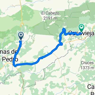
- Mombeltrán, Castille and León, Spain
A cycling route starting in Mombeltrán, Castille and León, Spain.
Overview
Mombeltran-San Esteban-PtoPico-San Esteban-PtoPedroBernardo-PtoSerranillos
created this 4 years ago
Route quality
Quiet road
16.5 km
(36 %)
Road
9.2 km
(20 %)
Paved
29.4 km
(64 %)
Asphalt
29.4 km
(64 %)
Undefined
16.5 km
(36 %)
Continue with Bikemap
You would like to ride Mombeltran-San Esteban-PtoPico-San Esteban-PtoPedroBernardo-PtoSerranillos or customize it for your own trip? Here is what you can do with this Bikemap route:
Free trial for 3 days, or one-time payment. More about Bikemap Premium.
Discover more Premium features.
Get Bikemap PremiumFrom our community
Open it in the app