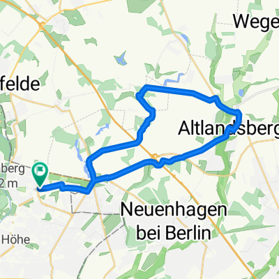
Berlin-Frankfurt(Oder) via ZR1 und R1
- 90.2 km
- 191 m
- 193 m
- Hellersdorf, State of Berlin, Germany
A cycling route starting in Hellersdorf, State of Berlin, Germany.
Overview
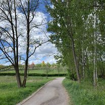
Race bike route with 5% inclines, partially asphalted bike paths, otherwise pure country road with little to much traffic.
Note: between Bad Freienw. and Wriezen, calming stretch, as the 167 is designated as a highway.
created this 17 years ago
Route quality
Road
16.2 km
(14 %)
Path
13.9 km
(12 %)
Paved
91.5 km
(79 %)
Unpaved
8.1 km
(7 %)
Asphalt
88.1 km
(76 %)
Ground
5.8 km
(5 %)
Route highlights
Cafe` "Rosengarten" lädt zum verweilen ein, Kaffee, leck. Kuchen, aber auch frische Getränke. Wriezener Strasse
Schloss-Hotel "Lake Side"
Continue with Bikemap
You would like to ride Bad Freienwalde Rundfahrt or customize it for your own trip? Here is what you can do with this Bikemap route:
Free trial for 3 days, or one-time payment. More about Bikemap Premium.
Discover more Premium features.
Get Bikemap PremiumFrom our community
Open it in the app