

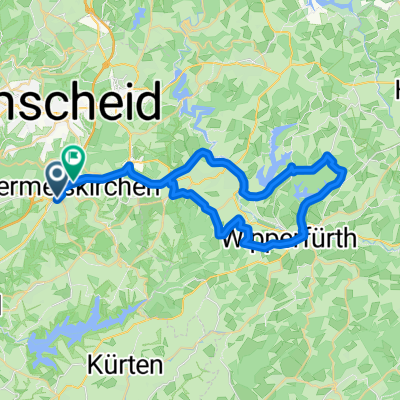
26102008 Sonntagstour
A cycling route starting in Wermelskirchen, North Rhine-Westphalia, Germany.
Overview
About this route
short tour, could have been longer
- -:--
- Duration
- 30.4 km
- Distance
- 509 m
- Ascent
- 576 m
- Descent
- ---
- Avg. speed
- 347 m
- Max. altitude

Route quality
Waytypes & surfaces along the route
Waytypes
Track
14.3 km
(47 %)
Quiet road
5.2 km
(17 %)
Surfaces
Paved
10.6 km
(35 %)
Unpaved
14.9 km
(49 %)
Asphalt
10 km
(33 %)
Gravel
7.9 km
(26 %)
Continue with Bikemap
Use, edit, or download this cycling route
You would like to ride 26102008 Sonntagstour or customize it for your own trip? Here is what you can do with this Bikemap route:
Free features
- Save this route as favorite or in collections
- Copy & plan your own version of this route
- Sync your route with Garmin or Wahoo
Premium features
Free trial for 3 days, or one-time payment. More about Bikemap Premium.
- Navigate this route on iOS & Android
- Export a GPX / KML file of this route
- Create your custom printout (try it for free)
- Download this route for offline navigation
Discover more Premium features.
Get Bikemap PremiumFrom our community
Other popular routes starting in Wermelskirchen
 :aqualon-Runde
- Distance
- 55.5 km
- Ascent
- 510 m
- Descent
- 510 m
- Location
- Wermelskirchen, North Rhine-Westphalia, Germany
 Rund um die Dhünntalsperrre
- Distance
- 38.9 km
- Ascent
- 540 m
- Descent
- 543 m
- Location
- Wermelskirchen, North Rhine-Westphalia, Germany
 Rund um die Große Dhünn
- Distance
- 50.2 km
- Ascent
- 596 m
- Descent
- 599 m
- Location
- Wermelskirchen, North Rhine-Westphalia, Germany
 Wk-wipperfürth
- Distance
- 44.5 km
- Ascent
- 590 m
- Descent
- 579 m
- Location
- Wermelskirchen, North Rhine-Westphalia, Germany
 Landschaftlich ruhige talsperrenrunde
- Distance
- 84.6 km
- Ascent
- 565 m
- Descent
- 576 m
- Location
- Wermelskirchen, North Rhine-Westphalia, Germany
 Sonntagsrunde April 2018
- Distance
- 48.6 km
- Ascent
- 350 m
- Descent
- 350 m
- Location
- Wermelskirchen, North Rhine-Westphalia, Germany
 Herbsttour zur Ahr
- Distance
- 121.7 km
- Ascent
- 128 m
- Descent
- 297 m
- Location
- Wermelskirchen, North Rhine-Westphalia, Germany
- Längs der Ruhr
- Distance
- 109.5 km
- Ascent
- 261 m
- Descent
- 532 m
- Location
- Wermelskirchen, North Rhine-Westphalia, Germany

Open it in the app