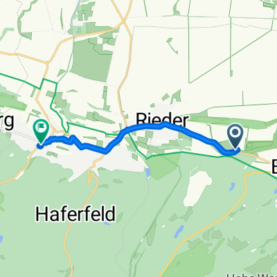
Selketal
A cycling route starting in Rieder, Saxony-Anhalt, Germany.
Overview
About this route
Weekend, beautiful weather and a good feeling in the legs. The start is in Gernrode at Osterteich. Following the narrow-gauge railway path, past the Heiligen Teich to the road (L243). A good trail with 150 meters of elevation gain over about 5 km. The last kilometer (50 meters elevation) to the Sternhaus goes over a narrow path on the left side of the road. At the Sternhaus, straight across the main road, always along the "Lange Allee", over the railway tracks and the intersection to Bremer Teich up to the turnoff to Friedrichshöhe (second on the left). It goes over a good trail just below Viktorshöhe. This is also the highest point of the route. Then it goes downhill past Bergrats-Müller Teich and Gondelteich. Those who want can shorten the route here and go directly to Günterberge. There is still a bit of uphill to the road between Friedrichsbrunn and Bärenrode. On the road, it continues via Allrode to Stiege. Between them, there is again about 200 meters elevation gain. Does anyone know a rideable path through the forest? First time from Stiege to Friedrichshöhe. I’m sure I found the best path. The long descent to Güntersberge on a "forest highway" compensates though. In Güntersberge, there is also the start of a family tour. Those who want to save the climbs up to here can take the narrow-gauge train to Güntersberge. Then it is only good trails and lightly trafficked roads downhill to Meisdorf. The entry point for the Selkestieg is at the outskirts of Güntersberge towards Siptenfelde. It goes gently downhill to Strassberg. Shortly after Strassberg, you must take the road, which is only lightly trafficked. Through the spa town of Alexisbad, you continue on the road to Mägdesprung. It is possible to ride left of the Selke at the outskirts of Alexisbad, but it has more of a trail character. At Mägdesprung, turn left into what I consider the most beautiful part of the Selke valley. The first half of the roughly 15 km to Meisdorf, up to the Selkemühle, is still open to car traffic. The rest is only for hikers, bikers... and cows.
- -:--
- Duration
- 87.8 km
- Distance
- 952 m
- Ascent
- 1,016 m
- Descent
- ---
- Avg. speed
- 545 m
- Max. altitude
Route quality
Waytypes & surfaces along the route
Waytypes
Track
37.8 km
(43 %)
Path
10.5 km
(12 %)
Surfaces
Paved
36 km
(41 %)
Unpaved
43.9 km
(50 %)
Asphalt
36 km
(41 %)
Gravel
35.1 km
(40 %)
Continue with Bikemap
Use, edit, or download this cycling route
You would like to ride Selketal or customize it for your own trip? Here is what you can do with this Bikemap route:
Free features
- Save this route as favorite or in collections
- Copy & plan your own version of this route
- Split it into stages to create a multi-day tour
- Sync your route with Garmin or Wahoo
Premium features
Free trial for 3 days, or one-time payment. More about Bikemap Premium.
- Navigate this route on iOS & Android
- Export a GPX / KML file of this route
- Create your custom printout (try it for free)
- Download this route for offline navigation
Discover more Premium features.
Get Bikemap PremiumFrom our community
Other popular routes starting in Rieder
 Rasante Fahrt
- Distance
- 4.3 km
- Ascent
- 3 m
- Descent
- 97 m
- Location
- Rieder, Saxony-Anhalt, Germany
 Gernrode-Thale-Friedrichsbrunn-Steinhaus-Osterteich
- Distance
- 31.7 km
- Ascent
- 544 m
- Descent
- 544 m
- Location
- Rieder, Saxony-Anhalt, Germany
 W_Harz01_Osterdeich_Alexisbad
- Distance
- 13.2 km
- Ascent
- 382 m
- Descent
- 325 m
- Location
- Rieder, Saxony-Anhalt, Germany
 Selketal
- Distance
- 87.8 km
- Ascent
- 952 m
- Descent
- 1,016 m
- Location
- Rieder, Saxony-Anhalt, Germany
 L242, Ballenstedt nach Friedrichsdorfstraße 3, Quedlinburg
- Distance
- 6.4 km
- Ascent
- 46 m
- Descent
- 76 m
- Location
- Rieder, Saxony-Anhalt, Germany
 Concordia See
- Distance
- 56.1 km
- Ascent
- 452 m
- Descent
- 450 m
- Location
- Rieder, Saxony-Anhalt, Germany
 Rieder Quedlinburg Blankenburg Thale Runde
- Distance
- 61.5 km
- Ascent
- 508 m
- Descent
- 508 m
- Location
- Rieder, Saxony-Anhalt, Germany
 Kornstraße 9, Ballenstedt nach Wernigerode
- Distance
- 35.6 km
- Ascent
- 458 m
- Descent
- 405 m
- Location
- Rieder, Saxony-Anhalt, Germany
Open it in the app

