

Challenge Schönewalde 4.Juni 2011
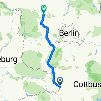
A cycling route starting in Holzdorf, Saxony-Anhalt, Germany.
Overview
About this route
The extension to Mehlsdorf-Knippeldorf is missing, as well as the same route back to Schönewalde, adding approximately 20 km more.
- -:--
- Duration
- 44.4 km
- Distance
- 94 m
- Ascent
- 92 m
- Descent
- ---
- Avg. speed
- ---
- Max. altitude

Route quality
Waytypes & surfaces along the route
Waytypes
Road
6.7 km
(15 %)
Quiet road
5.8 km
(13 %)
Surfaces
Paved
40 km
(90 %)
Asphalt
35.5 km
(80 %)
Concrete
4.4 km
(10 %)
Undefined
4.4 km
(10 %)
Continue with Bikemap
Use, edit, or download this cycling route
You would like to ride Challenge Schönewalde 4.Juni 2011 or customize it for your own trip? Here is what you can do with this Bikemap route:
Free features
- Save this route as favorite or in collections
- Copy & plan your own version of this route
- Sync your route with Garmin or Wahoo
Premium features
Free trial for 3 days, or one-time payment. More about Bikemap Premium.
- Navigate this route on iOS & Android
- Export a GPX / KML file of this route
- Create your custom printout (try it for free)
- Download this route for offline navigation
Discover more Premium features.
Get Bikemap PremiumFrom our community
Other popular routes starting in Holzdorf
 Über Stolzenhain, Mügeln, Holzdorf, Dahme und Zusatzrunde
- Distance
- 106.7 km
- Ascent
- 119 m
- Descent
- 119 m
- Location
- Holzdorf, Saxony-Anhalt, Germany
 Torgau - Rathen
- Distance
- 185.6 km
- Ascent
- 193 m
- Descent
- 54 m
- Location
- Holzdorf, Saxony-Anhalt, Germany
 Meinsdorf
- Distance
- 45.7 km
- Ascent
- 88 m
- Descent
- 88 m
- Location
- Holzdorf, Saxony-Anhalt, Germany
 Holzdorf - B101 - Linda - Mügeln - Schweinitz - Holzdorf
- Distance
- 38 km
- Ascent
- 85 m
- Descent
- 86 m
- Location
- Holzdorf, Saxony-Anhalt, Germany
 trainingsrunde 41Km
- Distance
- 41.2 km
- Ascent
- 80 m
- Descent
- 78 m
- Location
- Holzdorf, Saxony-Anhalt, Germany
 Testrunde
- Distance
- 54.3 km
- Ascent
- 105 m
- Descent
- 103 m
- Location
- Holzdorf, Saxony-Anhalt, Germany
 Elster und Elbe Radweg
- Distance
- 97.4 km
- Ascent
- 43 m
- Descent
- 44 m
- Location
- Holzdorf, Saxony-Anhalt, Germany
 Arnsnesta Nummer, Herzberg to Bahnhofstraße, Fehrbellin
- Distance
- 157.8 km
- Ascent
- 387 m
- Descent
- 426 m
- Location
- Holzdorf, Saxony-Anhalt, Germany
Open it in the app