

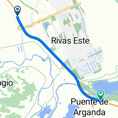
Rivas - Morata -Arganda
A cycling route starting in Rivas-Vaciamadrid, Madrid, Spain.
Overview
About this route
- -:--
- Duration
- 46.8 km
- Distance
- 427 m
- Ascent
- 402 m
- Descent
- ---
- Avg. speed
- ---
- Max. altitude

Continue with Bikemap
Use, edit, or download this cycling route
You would like to ride Rivas - Morata -Arganda or customize it for your own trip? Here is what you can do with this Bikemap route:
Free features
- Save this route as favorite or in collections
- Copy & plan your own version of this route
- Sync your route with Garmin or Wahoo
Premium features
Free trial for 3 days, or one-time payment. More about Bikemap Premium.
- Navigate this route on iOS & Android
- Export a GPX / KML file of this route
- Create your custom printout (try it for free)
- Download this route for offline navigation
Discover more Premium features.
Get Bikemap PremiumFrom our community
Other popular routes starting in Rivas-Vaciamadrid
 Rivas-Cerro de los Ángeles
- Distance
- 37.6 km
- Ascent
- 184 m
- Descent
- 186 m
- Location
- Rivas-Vaciamadrid, Madrid, Spain
 Cerro de Los Angeles
- Distance
- 55.2 km
- Ascent
- 358 m
- Descent
- 360 m
- Location
- Rivas-Vaciamadrid, Madrid, Spain
 Campo Real (R-23)
- Distance
- 49.7 km
- Ascent
- 434 m
- Descent
- 434 m
- Location
- Rivas-Vaciamadrid, Madrid, Spain
 Short bike tour from Rivas-Vaciamadrid to Arganda del Rey
- Distance
- 3.9 km
- Ascent
- 9 m
- Descent
- 32 m
- Location
- Rivas-Vaciamadrid, Madrid, Spain
 Rivas, San Martín de la Vega, Ciempozuelos (corta) San Martín (larga)
- Distance
- 38 km
- Ascent
- 78 m
- Descent
- 96 m
- Location
- Rivas-Vaciamadrid, Madrid, Spain
 Trincheras y Túneles cerca de Arganda
- Distance
- 39.3 km
- Ascent
- 123 m
- Descent
- 125 m
- Location
- Rivas-Vaciamadrid, Madrid, Spain
 Colombiano del Reves
- Distance
- 109.6 km
- Ascent
- 682 m
- Descent
- 682 m
- Location
- Rivas-Vaciamadrid, Madrid, Spain
 Rivas - Morata -Arganda
- Distance
- 46.8 km
- Ascent
- 427 m
- Descent
- 402 m
- Location
- Rivas-Vaciamadrid, Madrid, Spain
Open it in the app