

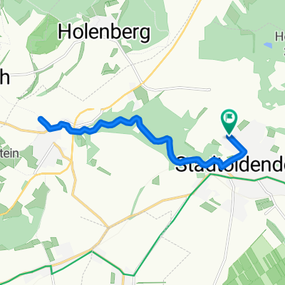
Mardieksweg 5, Stadtoldendorf nach Mardieksweg 7, Stadtoldendorf
A cycling route starting in Stadtoldendorf, Lower Saxony, Germany.
Overview
About this route
- 1 h 16 min
- Duration
- 16.4 km
- Distance
- 363 m
- Ascent
- 359 m
- Descent
- 13 km/h
- Avg. speed
- ---
- Max. altitude
Route photos


Route quality
Waytypes & surfaces along the route
Waytypes
Track
13.8 km
(84 %)
Quiet road
2.1 km
(13 %)
Path
0.5 km
(3 %)
Surfaces
Paved
5.1 km
(31 %)
Unpaved
10.7 km
(65 %)
Gravel
8.5 km
(52 %)
Asphalt
5.1 km
(31 %)
Continue with Bikemap
Use, edit, or download this cycling route
You would like to ride Mardieksweg 5, Stadtoldendorf nach Mardieksweg 7, Stadtoldendorf or customize it for your own trip? Here is what you can do with this Bikemap route:
Free features
- Save this route as favorite or in collections
- Copy & plan your own version of this route
- Sync your route with Garmin or Wahoo
Premium features
Free trial for 3 days, or one-time payment. More about Bikemap Premium.
- Navigate this route on iOS & Android
- Export a GPX / KML file of this route
- Create your custom printout (try it for free)
- Download this route for offline navigation
Discover more Premium features.
Get Bikemap PremiumFrom our community
Other popular routes starting in Stadtoldendorf
 Vom Regen erwischt!
- Distance
- 11.5 km
- Ascent
- 181 m
- Descent
- 199 m
- Location
- Stadtoldendorf, Lower Saxony, Germany
 Homburgrunde
- Distance
- 8.3 km
- Ascent
- 453 m
- Descent
- 441 m
- Location
- Stadtoldendorf, Lower Saxony, Germany
 StOD 001: Stadtoldendorf - Hattorf
- Distance
- 65.1 km
- Ascent
- 224 m
- Descent
- 260 m
- Location
- Stadtoldendorf, Lower Saxony, Germany
 Mardieksweg 5, Stadtoldendorf nach Mardieksweg 7, Stadtoldendorf
- Distance
- 16.4 km
- Ascent
- 363 m
- Descent
- 359 m
- Location
- Stadtoldendorf, Lower Saxony, Germany
 Kirschblütentour in der Rühlerschweiz
- Distance
- 22.3 km
- Ascent
- 329 m
- Descent
- 344 m
- Location
- Stadtoldendorf, Lower Saxony, Germany
 über den Holzberg
- Distance
- 24 km
- Ascent
- 426 m
- Descent
- 426 m
- Location
- Stadtoldendorf, Lower Saxony, Germany
 Feierabendrunde - Um die Homburg
- Distance
- 21.3 km
- Ascent
- 480 m
- Descent
- 455 m
- Location
- Stadtoldendorf, Lower Saxony, Germany
 kellbergrunde
- Distance
- 19.8 km
- Ascent
- 283 m
- Descent
- 280 m
- Location
- Stadtoldendorf, Lower Saxony, Germany
Open it in the app