- 19.8 km
- 162 m
- 572 m
- Benicassim, Valencia, Spain
Subida al Bruno y les Santes 2011
A cycling route starting in Benicassim, Valencia, Spain.
Overview
About this route
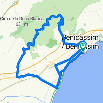
Departure from Benicasim heading towards Desierto de la Palmas on asphalt. Once we pass the Monastery, we turn right onto a dirt path to climb to Bruno and descend to La Pobla Tornesa to climb les Santes. We climb again and descend, I believe, on the worst path in the entire Desierto de las Palmas, horrible—I don't think I'll descend there again. Finally, after climbing four mountain peaks throughout the route, we calmly return on asphalt until reaching the end of the route. (16/04/11)
- -:--
- Duration
- 33.5 km
- Distance
- 965 m
- Ascent
- 969 m
- Descent
- ---
- Avg. speed
- ---
- Max. altitude
created this 14 years ago
Route quality
Waytypes & surfaces along the route
Waytypes
Track
13.8 km
(41 %)
Road
12.4 km
(37 %)
Quiet road
7.4 km
(22 %)
Surfaces
Paved
2.3 km
(7 %)
Unpaved
13.8 km
(41 %)
Gravel
9.4 km
(28 %)
Unpaved (undefined)
3.7 km
(11 %)
Continue with Bikemap
Use, edit, or download this cycling route
You would like to ride Subida al Bruno y les Santes 2011 or customize it for your own trip? Here is what you can do with this Bikemap route:
Free features
- Save this route as favorite or in collections
- Copy & plan your own version of this route
- Sync your route with Garmin or Wahoo
Premium features
Free trial for 3 days, or one-time payment. More about Bikemap Premium.
- Navigate this route on iOS & Android
- Export a GPX / KML file of this route
- Create your custom printout (try it for free)
- Download this route for offline navigation
Discover more Premium features.
Get Bikemap PremiumFrom our community
Other popular routes starting in Benicassim
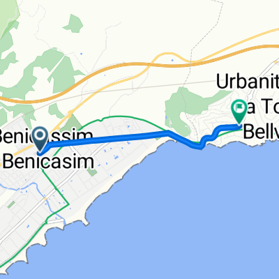
- A-147, Benicàssim nach Urbanización Torre Bellver, Oropesa
- Subida a las antenas del Bartolo 2010
- 24.5 km
- 822 m
- 822 m
- Benicassim, Valencia, Spain
- recorrido bici 40.1 km
- 40.2 km
- 446 m
- 444 m
- Benicassim, Valencia, Spain
- recorrido bici 44.2 km
- 44.2 km
- 503 m
- 500 m
- Benicassim, Valencia, Spain
- Spanien Benicassim
- 14.9 km
- 355 m
- 356 m
- Benicassim, Valencia, Spain
- Recording from October 21, 12:43
- 6 km
- 8 m
- 12 m
- Benicassim, Valencia, Spain
- Aptos. Vilacasim - Basurero - Desierto - Aptos. Vilacasim
- 29.7 km
- 770 m
- 768 m
- Benicassim, Valencia, Spain
- 1º etapa castello 2014
- 3 km
- 43 m
- 52 m
- Benicassim, Valencia, Spain
Open it in the app


