

Cima Carega
A cycling route starting in Recoaro Terme, Veneto, Italy.
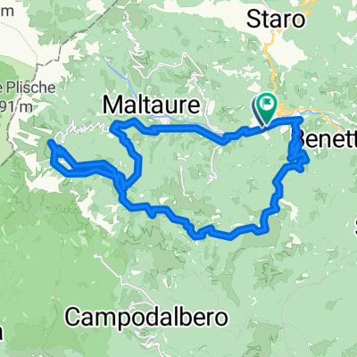
Overview
About this route
<p>Start altitude 1.250 m</p>
<p>Finish altitude 1.250 m</p>
<p>Maximum altitude 2.259 m 1.250 m 1.250 m</p>
<p>Total travel time 07,00 h</p>
<p>Elevation gain 1.250 m</p>
<p>Elevation loss 1.250 m</p>
<p>Loop hike with a starting and ending point at the Cesare Battisti hut (Recoaro Terme, Vicenza), aiming for Cima Carega, passing by the huts Pompeo Scalorbi (1750 m) and Mario Fraccaroli (2230 m); the route has an E difficulty, with the sole exception of the CAI 113 trail with an EE section. Route:
Cesare Battisti -> CAI 105 trail to CAI 113 (E) -> CAI 113 trail to CAI 182 (EE) -> CAI 182 trail to the Scalorbi hut (E) -> trail 182 to the Scalorbi Hut (E) -> CAI 192 trail to CAI 157 (E) -> CAI 157 trail to the Fraccaroli hut (E) -> CAI 157 + 109 trail to the Scalorbi Hut (E) -> CAI 182 trail to CAI 110 (E) -> CAI 110 Battisti hut (E)</p>
Translated, show original (Italian)- -:--
- Duration
- 14.6 km
- Distance
- 1,309 m
- Ascent
- 1,309 m
- Descent
- ---
- Avg. speed
- 2,199 m
- Max. altitude

Continue with Bikemap
Use, edit, or download this cycling route
You would like to ride Cima Carega or customize it for your own trip? Here is what you can do with this Bikemap route:
Free features
- Save this route as favorite or in collections
- Copy & plan your own version of this route
- Sync your route with Garmin or Wahoo
Premium features
Free trial for 3 days, or one-time payment. More about Bikemap Premium.
- Navigate this route on iOS & Android
- Export a GPX / KML file of this route
- Create your custom printout (try it for free)
- Download this route for offline navigation
Discover more Premium features.
Get Bikemap PremiumFrom our community
Other popular routes starting in Recoaro Terme
 Cima Carega
- Distance
- 14.6 km
- Ascent
- 1,309 m
- Descent
- 1,309 m
- Location
- Recoaro Terme, Veneto, Italy
 Da Recoaro 1000 al Rifugio Battisti
- Distance
- 32 km
- Ascent
- 101,393 m
- Descent
- 101,393 m
- Location
- Recoaro Terme, Veneto, Italy
 Staro - Campogrosso
- Distance
- 10.5 km
- Ascent
- 883 m
- Descent
- 67 m
- Location
- Recoaro Terme, Veneto, Italy
 rifugio cesare battisti
- Distance
- 25.9 km
- Ascent
- 945 m
- Descent
- 944 m
- Location
- Recoaro Terme, Veneto, Italy
 Cerealto
- Distance
- 37.2 km
- Ascent
- 814 m
- Descent
- 814 m
- Location
- Recoaro Terme, Veneto, Italy
 Giro Passo Xon
- Distance
- 31.3 km
- Ascent
- 1,013 m
- Descent
- 1,022 m
- Location
- Recoaro Terme, Veneto, Italy
 Staro - Campogrosso
- Distance
- 9.3 km
- Ascent
- 893 m
- Descent
- 78 m
- Location
- Recoaro Terme, Veneto, Italy
 Recoaro tour
- Distance
- 32.3 km
- Ascent
- 915 m
- Descent
- 916 m
- Location
- Recoaro Terme, Veneto, Italy
Open it in the app