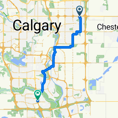
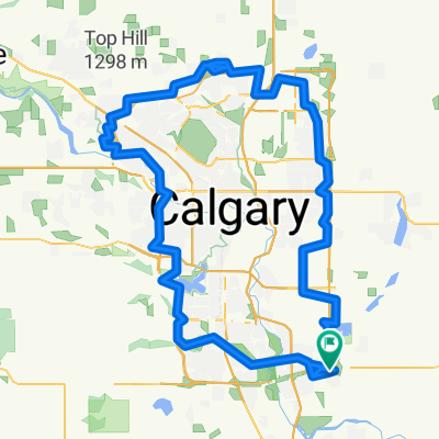
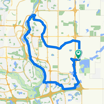
Chestermere Loop
A cycling route starting in Chestermere, Alberta, Canada.
Overview
About this route
- -:--
- Duration
- 11.8 km
- Distance
- 28 m
- Ascent
- 29 m
- Descent
- ---
- Avg. speed
- 1,034 m
- Max. altitude
Continue with Bikemap
Use, edit, or download this cycling route
You would like to ride Chestermere Loop or customize it for your own trip? Here is what you can do with this Bikemap route:
Free features
- Save this route as favorite or in collections
- Copy & plan your own version of this route
- Sync your route with Garmin or Wahoo
Premium features
Free trial for 3 days, or one-time payment. More about Bikemap Premium.
- Navigate this route on iOS & Android
- Export a GPX / KML file of this route
- Create your custom printout (try it for free)
- Download this route for offline navigation
Discover more Premium features.
Get Bikemap PremiumFrom our community
Other popular routes starting in Chestermere
Cavalgada estável- Distance
- 19.6 km
- Ascent
- 140 m
- Descent
- 137 m
- Location
- Chestermere, Alberta, Canada
Around Calgary - 1- Distance
- 147.7 km
- Ascent
- 494 m
- Descent
- 494 m
- Location
- Chestermere, Alberta, Canada
Chestermere Loop- Distance
- 11.8 km
- Ascent
- 28 m
- Descent
- 29 m
- Location
- Chestermere, Alberta, Canada
Steady ride in Chestermere- Distance
- 2.1 km
- Ascent
- 12 m
- Descent
- 4 m
- Location
- Chestermere, Alberta, Canada
My to/from work route- Distance
- 26.4 km
- Ascent
- 80 m
- Descent
- 102 m
- Location
- Chestermere, Alberta, Canada
101 Westchester Way, Chestermere to 108 Sandpiper Pl, Chestermere- Distance
- 62.1 km
- Ascent
- 194 m
- Descent
- 193 m
- Location
- Chestermere, Alberta, Canada
Canal + Bow River SW Loop- Distance
- 41.4 km
- Ascent
- 136 m
- Descent
- 134 m
- Location
- Chestermere, Alberta, Canada
Greenway P4 - to Annies- Distance
- 33.7 km
- Ascent
- 97 m
- Descent
- 131 m
- Location
- Chestermere, Alberta, Canada
Open it in the app


