

main-route
A cycling route starting in Gädheim, Bavaria, Germany.
Overview
About this route
meine strecke wenn ich ganzen tag zeit habe
- -:--
- Duration
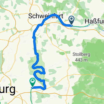
- 77.1 km
- Distance
- 400 m
- Ascent
- 404 m
- Descent
- ---
- Avg. speed
- ---
- Max. altitude

Continue with Bikemap
Use, edit, or download this cycling route
You would like to ride main-route or customize it for your own trip? Here is what you can do with this Bikemap route:
Free features
- Save this route as favorite or in collections
- Copy & plan your own version of this route
- Sync your route with Garmin or Wahoo
Premium features
Free trial for 3 days, or one-time payment. More about Bikemap Premium.
- Navigate this route on iOS & Android
- Export a GPX / KML file of this route
- Create your custom printout (try it for free)
- Download this route for offline navigation
Discover more Premium features.
Get Bikemap PremiumFrom our community
Other popular routes starting in Gädheim
 Brief bike tour through the windmills
- Distance
- 7.1 km
- Ascent
- 96 m
- Descent
- 96 m
- Location
- Gädheim, Bavaria, Germany
 Einfache Fahrt in
- Distance
- 14.8 km
- Ascent
- 176 m
- Descent
- 176 m
- Location
- Gädheim, Bavaria, Germany
 Vom Maintal in den Steigerwald
- Distance
- 52.3 km
- Ascent
- 359 m
- Descent
- 360 m
- Location
- Gädheim, Bavaria, Germany
 Gädheim Untertheres
- Distance
- 8.3 km
- Ascent
- 85 m
- Descent
- 148 m
- Location
- Gädheim, Bavaria, Germany
 Etappe_05_bike
- Distance
- 62.7 km
- Ascent
- 133 m
- Descent
- 177 m
- Location
- Gädheim, Bavaria, Germany
 main-route
- Distance
- 77.1 km
- Ascent
- 400 m
- Descent
- 404 m
- Location
- Gädheim, Bavaria, Germany
 Langsame Fahrt in
- Distance
- 31.1 km
- Ascent
- 102 m
- Descent
- 107 m
- Location
- Gädheim, Bavaria, Germany
 Zabelsteinrunde
- Distance
- 41.9 km
- Ascent
- 625 m
- Descent
- 573 m
- Location
- Gädheim, Bavaria, Germany
Open it in the app