

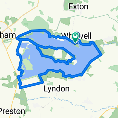
Rutland Water w/o family 😜
A cycling route starting in Empingham, England, United Kingdom.
Overview
About this route
- 1 h 43 min
- Duration
- 34.9 km
- Distance
- 30 m
- Ascent
- 80 m
- Descent
- 20.3 km/h
- Avg. speed
- ---
- Max. altitude

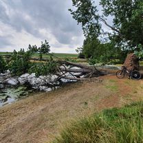
Route photos


Route quality
Waytypes & surfaces along the route
Waytypes
Cycleway
23.4 km
(67 %)
Road
6.6 km
(19 %)
Surfaces
Paved
15.3 km
(44 %)
Unpaved
11.2 km
(32 %)
Asphalt
15.3 km
(44 %)
Gravel
11.2 km
(32 %)
Undefined
8.4 km
(24 %)
Continue with Bikemap
Use, edit, or download this cycling route
You would like to ride Rutland Water w/o family 😜 or customize it for your own trip? Here is what you can do with this Bikemap route:
Free features
- Save this route as favorite or in collections
- Copy & plan your own version of this route
- Sync your route with Garmin or Wahoo
Premium features
Free trial for 3 days, or one-time payment. More about Bikemap Premium.
- Navigate this route on iOS & Android
- Export a GPX / KML file of this route
- Create your custom printout (try it for free)
- Download this route for offline navigation
Discover more Premium features.
Get Bikemap PremiumFrom our community
Other popular routes starting in Empingham
 Rutland water
- Distance
- 24.4 km
- Ascent
- 103 m
- Descent
- 101 m
- Location
- Empingham, England, United Kingdom
 Bull Brig Lane 2, Whitwell to Bull Brig Lane 2, Whitwell
- Distance
- 35 km
- Ascent
- 119 m
- Descent
- 119 m
- Location
- Empingham, England, United Kingdom
 Recovered Route
- Distance
- 9 km
- Ascent
- 66 m
- Descent
- 68 m
- Location
- Empingham, England, United Kingdom
 Scotty Ash scenic route.
- Distance
- 43.3 km
- Ascent
- 277 m
- Descent
- 276 m
- Location
- Empingham, England, United Kingdom
 Rutland
- Distance
- 24.4 km
- Ascent
- 119 m
- Descent
- 119 m
- Location
- Empingham, England, United Kingdom
 rutland west
- Distance
- 34.9 km
- Ascent
- 351 m
- Descent
- 351 m
- Location
- Empingham, England, United Kingdom
 Rutland Water w/o family 😜
- Distance
- 34.9 km
- Ascent
- 30 m
- Descent
- 80 m
- Location
- Empingham, England, United Kingdom
 Route in Oakham
- Distance
- 37.1 km
- Ascent
- 242 m
- Descent
- 239 m
- Location
- Empingham, England, United Kingdom
Open it in the app