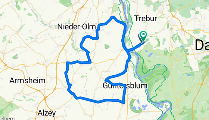
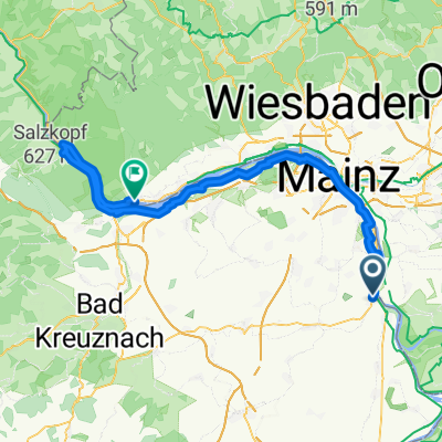
Optimierte Tour
A cycling route starting in Nierstein, Rhineland-Palatinate, Germany.
Overview
About this route
- -:--
- Duration
- 78.6 km
- Distance
- 532 m
- Ascent
- 535 m
- Descent
- ---
- Avg. speed
- ---
- Max. altitude
Route quality
Waytypes & surfaces along the route
Waytypes
Road
11 km
(14 %)
Track
11 km
(14 %)
Surfaces
Paved
65.3 km
(83 %)
Unpaved
5.5 km
(7 %)
Asphalt
60.5 km
(77 %)
Ground
5.5 km
(7 %)
Route highlights
Points of interest along the route
Point of interest after 8.5 km
1. Anstieg
Point of interest after 22.3 km
2. Anstieg
Point of interest after 78.1 km
Start
Continue with Bikemap
Use, edit, or download this cycling route
You would like to ride Optimierte Tour or customize it for your own trip? Here is what you can do with this Bikemap route:
Free features
- Save this route as favorite or in collections
- Copy & plan your own version of this route
- Sync your route with Garmin or Wahoo
Premium features
Free trial for 3 days, or one-time payment. More about Bikemap Premium.
- Navigate this route on iOS & Android
- Export a GPX / KML file of this route
- Create your custom printout (try it for free)
- Download this route for offline navigation
Discover more Premium features.
Get Bikemap PremiumFrom our community
Other popular routes starting in Nierstein
- Weinbergrunde Nierstein-Schwabsburg
- Distance
- 10.1 km
- Ascent
- 214 m
- Descent
- 213 m
- Location
- Nierstein, Rhineland-Palatinate, Germany
- Rheinhessen-Tour
- Distance
- 115.9 km
- Ascent
- 617 m
- Descent
- 619 m
- Location
- Nierstein, Rhineland-Palatinate, Germany
- Durch die Weinberge oppenheim Nierstein
- Distance
- 8.2 km
- Ascent
- 114 m
- Descent
- 117 m
- Location
- Nierstein, Rhineland-Palatinate, Germany
- Auf alten Bahntrassen
- Distance
- 33.5 km
- Ascent
- 330 m
- Descent
- 333 m
- Location
- Nierstein, Rhineland-Palatinate, Germany
- Route im Schneckentempo in Trebur
- Distance
- 5.8 km
- Ascent
- 0 m
- Descent
- 4 m
- Location
- Nierstein, Rhineland-Palatinate, Germany
- Rheinhänge Oppenh Guntersbl
- Distance
- 22.5 km
- Ascent
- 346 m
- Descent
- 346 m
- Location
- Nierstein, Rhineland-Palatinate, Germany
- Moselradweg Teil 2
- Distance
- 301.9 km
- Ascent
- 152 m
- Descent
- 61 m
- Location
- Nierstein, Rhineland-Palatinate, Germany
- Route ab Nierstein
- Distance
- 43.1 km
- Ascent
- 221 m
- Descent
- 221 m
- Location
- Nierstein, Rhineland-Palatinate, Germany
Open it in the app