

pragraten-johannishutte CLONED FROM ROUTE 614526
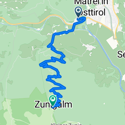
A cycling route starting in Matrei in Osttirol, Tyrol, Austria.
Overview
About this route
- -:--
- Duration
- 20.8 km
- Distance
- 1,319 m
- Ascent
- 166 m
- Descent
- ---
- Avg. speed
- ---
- Max. altitude

Route quality
Waytypes & surfaces along the route
Waytypes
Busy road
11.6 km
(56 %)
Track
8.1 km
(39 %)
Surfaces
Paved
6.6 km
(32 %)
Unpaved
8.1 km
(39 %)
Gravel
7.1 km
(34 %)
Asphalt
6.6 km
(32 %)
Continue with Bikemap
Use, edit, or download this cycling route
You would like to ride pragraten-johannishutte CLONED FROM ROUTE 614526 or customize it for your own trip? Here is what you can do with this Bikemap route:
Free features
- Save this route as favorite or in collections
- Copy & plan your own version of this route
- Sync your route with Garmin or Wahoo
Premium features
Free trial for 3 days, or one-time payment. More about Bikemap Premium.
- Navigate this route on iOS & Android
- Export a GPX / KML file of this route
- Create your custom printout (try it for free)
- Download this route for offline navigation
Discover more Premium features.
Get Bikemap PremiumFrom our community
Other popular routes starting in Matrei in Osttirol
 radweg_virgental_wasserfall
- Distance
- 48.4 km
- Ascent
- 1,248 m
- Descent
- 1,247 m
- Location
- Matrei in Osttirol, Tyrol, Austria
 Matrei to Lienz
- Distance
- 29 km
- Ascent
- 44 m
- Descent
- 341 m
- Location
- Matrei in Osttirol, Tyrol, Austria
 20140709_085002.gpx
- Distance
- 26.1 km
- Ascent
- 999 m
- Descent
- 469 m
- Location
- Matrei in Osttirol, Tyrol, Austria
 zedl - zunig kurz u steil
- Distance
- 8.1 km
- Ascent
- 908 m
- Descent
- 40 m
- Location
- Matrei in Osttirol, Tyrol, Austria
 Von Kals zur Lucknerhütte
- Distance
- 9.4 km
- Ascent
- 953 m
- Descent
- 72 m
- Location
- Matrei in Osttirol, Tyrol, Austria
 Cimaross Runde
- Distance
- 42.2 km
- Ascent
- 1,765 m
- Descent
- 1,765 m
- Location
- Matrei in Osttirol, Tyrol, Austria
 Reise durch Norditalien und Tirol
- Distance
- 756.4 km
- Ascent
- 4,517 m
- Descent
- 5,509 m
- Location
- Matrei in Osttirol, Tyrol, Austria
 pragraten-johannishutte CLONED FROM ROUTE 614526
- Distance
- 20.8 km
- Ascent
- 1,319 m
- Descent
- 166 m
- Location
- Matrei in Osttirol, Tyrol, Austria
Open it in the app