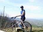
Göppingen - Burren - Krummwälden
A cycling route starting in Eislingen, Baden-Wurttemberg, Germany.
Overview
About this route
Really awesome route with a nasty calf-buster climb at Burren and an insanely great descent from Spitzberg. Unfortunately, I can't guarantee the route down to Kuchen because there are so many paths in the forest that it's hard to get an overview :-/
Well-deserved rest after the tour in Krummwälden at the Bürgerstüble :-)
- -:--
- Duration
- 33.7 km
- Distance
- 539 m
- Ascent
- 546 m
- Descent
- ---
- Avg. speed
- ---
- Max. altitude
Continue with Bikemap
Use, edit, or download this cycling route
You would like to ride Göppingen - Burren - Krummwälden or customize it for your own trip? Here is what you can do with this Bikemap route:
Free features
- Save this route as favorite or in collections
- Copy & plan your own version of this route
- Sync your route with Garmin or Wahoo
Premium features
Free trial for 3 days, or one-time payment. More about Bikemap Premium.
- Navigate this route on iOS & Android
- Export a GPX / KML file of this route
- Create your custom printout (try it for free)
- Download this route for offline navigation
Discover more Premium features.
Get Bikemap PremiumFrom our community
Other popular routes starting in Eislingen
 Esslingen
- Distance
- 35.6 km
- Ascent
- 17 m
- Descent
- 106 m
- Location
- Eislingen, Baden-Wurttemberg, Germany
 Schlater Wald über Grünenberg
- Distance
- 27.9 km
- Ascent
- 322 m
- Descent
- 322 m
- Location
- Eislingen, Baden-Wurttemberg, Germany
 Hohenstaufen (über Göppingen)
- Distance
- 21.8 km
- Ascent
- 314 m
- Descent
- 317 m
- Location
- Eislingen, Baden-Wurttemberg, Germany
 Göppingen Golfplatz
- Distance
- 13.4 km
- Ascent
- 195 m
- Descent
- 198 m
- Location
- Eislingen, Baden-Wurttemberg, Germany
 Hohenstaufen und "Trasse" (über Wäschenbeuren)
- Distance
- 31 km
- Ascent
- 375 m
- Descent
- 375 m
- Location
- Eislingen, Baden-Wurttemberg, Germany
 Nassachtal-Herrenmühle
- Distance
- 36.9 km
- Ascent
- 241 m
- Descent
- 240 m
- Location
- Eislingen, Baden-Wurttemberg, Germany
 Hohenstaufen und Rechberg (über Ottenbach)
- Distance
- 29.1 km
- Ascent
- 422 m
- Descent
- 425 m
- Location
- Eislingen, Baden-Wurttemberg, Germany
 "Trasse" und Rechberg
- Distance
- 40.5 km
- Ascent
- 442 m
- Descent
- 442 m
- Location
- Eislingen, Baden-Wurttemberg, Germany
Open it in the app


