

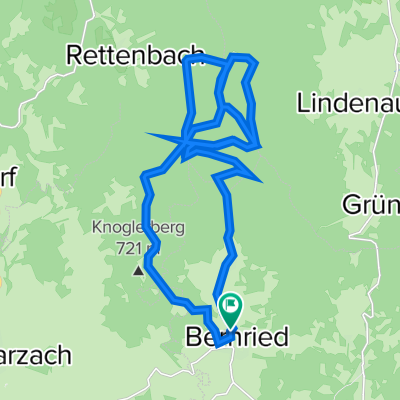
D_Bayern_Bernried-Krin-Böbrach-BöbrachBach-Panoramaweg-Rieth-Ebengasse-Amtsfleck_RR-13,9km-500hm
A cycling route starting in Bernried, Bavaria, Germany.
Overview
About this route
very easy, as all are asphalt and forest roads
- -:--
- Duration
- 13.9 km
- Distance
- 569 m
- Ascent
- 568 m
- Descent
- ---
- Avg. speed
- 699 m
- Max. altitude

Route quality
Waytypes & surfaces along the route
Waytypes
Track
6.8 km
(49 %)
Quiet road
5.6 km
(40 %)
Surfaces
Paved
6.8 km
(49 %)
Unpaved
4.2 km
(30 %)
Asphalt
5.6 km
(40 %)
Gravel
2.5 km
(18 %)
Continue with Bikemap
Use, edit, or download this cycling route
You would like to ride D_Bayern_Bernried-Krin-Böbrach-BöbrachBach-Panoramaweg-Rieth-Ebengasse-Amtsfleck_RR-13,9km-500hm or customize it for your own trip? Here is what you can do with this Bikemap route:
Free features
- Save this route as favorite or in collections
- Copy & plan your own version of this route
- Sync your route with Garmin or Wahoo
Premium features
Free trial for 3 days, or one-time payment. More about Bikemap Premium.
- Navigate this route on iOS & Android
- Export a GPX / KML file of this route
- Create your custom printout (try it for free)
- Download this route for offline navigation
Discover more Premium features.
Get Bikemap PremiumFrom our community
Other popular routes starting in Bernried
 TBW5 ganz Neu bis Bischofsmais
- Distance
- 32.5 km
- Ascent
- 1,133 m
- Descent
- 841 m
- Location
- Bernried, Bavaria, Germany
 Leithen 27, Bernried nach Kalteck 11, Achslach
- Distance
- 3.8 km
- Ascent
- 316 m
- Descent
- 16 m
- Location
- Bernried, Bavaria, Germany
 Böbracher Wasserfälle
- Distance
- 6.7 km
- Ascent
- 247 m
- Descent
- 82 m
- Location
- Bernried, Bavaria, Germany
 Santengel-40-990
- Distance
- 39.9 km
- Ascent
- 1,001 m
- Descent
- 1,002 m
- Location
- Bernried, Bavaria, Germany
 Hofstetten 2, Bernried nach Schützenstraße 4A, Grafling
- Distance
- 9.6 km
- Ascent
- 275 m
- Descent
- 302 m
- Location
- Bernried, Bavaria, Germany
 Elsenanger 2, Bernried nach Kelheimwinzerstraße 1
- Distance
- 94.1 km
- Ascent
- 507 m
- Descent
- 554 m
- Location
- Bernried, Bavaria, Germany
 Trail-Surfen am Hirschenstein
- Distance
- 26.5 km
- Ascent
- 967 m
- Descent
- 947 m
- Location
- Bernried, Bavaria, Germany
 Test
Test- Distance
- 38.5 km
- Ascent
- 1,160 m
- Descent
- 1,160 m
- Location
- Bernried, Bavaria, Germany
Open it in the app