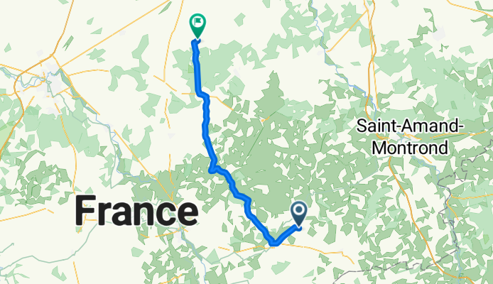
airfield issoudun
A cycling route starting in Châteaumeillant, Centre-Val de Loire, France.
Overview
About this route
- -:--
- Duration
- 49 km
- Distance
- 171 m
- Ascent
- 250 m
- Descent
- ---
- Avg. speed
- ---
- Max. altitude
Route quality
Waytypes & surfaces along the route
Waytypes
Road
29.5 km
(60 %)
Busy road
9.4 km
(19 %)
Surfaces
Paved
16.6 km
(34 %)
Unpaved
1 km
(2 %)
Asphalt
16.6 km
(34 %)
Ground
1 km
(2 %)
Undefined
31.4 km
(64 %)
Route highlights
Points of interest along the route
Point of interest after 4.7 km
Continue with Bikemap
Use, edit, or download this cycling route
You would like to ride airfield issoudun or customize it for your own trip? Here is what you can do with this Bikemap route:
Free features
- Save this route as favorite or in collections
- Copy & plan your own version of this route
- Sync your route with Garmin or Wahoo
Premium features
Free trial for 3 days, or one-time payment. More about Bikemap Premium.
- Navigate this route on iOS & Android
- Export a GPX / KML file of this route
- Create your custom printout (try it for free)
- Download this route for offline navigation
Discover more Premium features.
Get Bikemap PremiumFrom our community
Other popular routes starting in Châteaumeillant
- st.pierre le bois shortcut
- Distance
- 41.4 km
- Ascent
- 216 m
- Descent
- 215 m
- Location
- Châteaumeillant, Centre-Val de Loire, France
- airfield issoudun
- Distance
- 49 km
- Ascent
- 171 m
- Descent
- 250 m
- Location
- Châteaumeillant, Centre-Val de Loire, France
- privet-tercillat and retour
- Distance
- 66.7 km
- Ascent
- 414 m
- Descent
- 417 m
- Location
- Châteaumeillant, Centre-Val de Loire, France
- J-9, on approche de la Réserve de la Touche
- Distance
- 94.7 km
- Ascent
- 224 m
- Descent
- 534 m
- Location
- Châteaumeillant, Centre-Val de Loire, France
- la chatre superu
- Distance
- 24.1 km
- Ascent
- 129 m
- Descent
- 134 m
- Location
- Châteaumeillant, Centre-Val de Loire, France
- lignere shopping
- Distance
- 26.9 km
- Ascent
- 123 m
- Descent
- 196 m
- Location
- Châteaumeillant, Centre-Val de Loire, France
- Marcais id st. roch
- Distance
- 49.6 km
- Ascent
- 233 m
- Descent
- 236 m
- Location
- Châteaumeillant, Centre-Val de Loire, France
- Privet to Budapest
- Distance
- 1,914 km
- Ascent
- 746 m
- Descent
- 869 m
- Location
- Châteaumeillant, Centre-Val de Loire, France
Open it in the app