

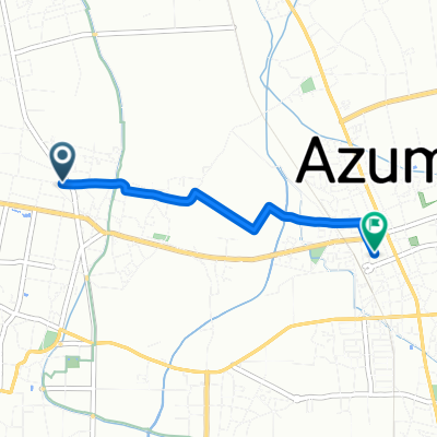
安曇野市 to 安曇野市
A cycling route starting in Toyoshina, Nagano, Japan.
Overview
About this route
- 2 h 8 min
- Duration
- 18.5 km
- Distance
- 72 m
- Ascent
- 131 m
- Descent
- 8.7 km/h
- Avg. speed
- ---
- Max. altitude

Route quality
Waytypes & surfaces along the route
Waytypes
Road
8.9 km
(48 %)
Quiet road
2.4 km
(13 %)
Continue with Bikemap
Use, edit, or download this cycling route
You would like to ride 安曇野市 to 安曇野市 or customize it for your own trip? Here is what you can do with this Bikemap route:
Free features
- Save this route as favorite or in collections
- Copy & plan your own version of this route
- Sync your route with Garmin or Wahoo
Premium features
Free trial for 3 days, or one-time payment. More about Bikemap Premium.
- Navigate this route on iOS & Android
- Export a GPX / KML file of this route
- Create your custom printout (try it for free)
- Download this route for offline navigation
Discover more Premium features.
Get Bikemap PremiumFrom our community
Other popular routes starting in Toyoshina
 bis azumino
- Distance
- 505.6 km
- Ascent
- 4,149 m
- Descent
- 4,510 m
- Location
- Toyoshina, Nagano, Japan
 田沢ー白馬
田沢ー白馬- Distance
- 56.2 km
- Ascent
- 347 m
- Descent
- 204 m
- Location
- Toyoshina, Nagano, Japan
 蝶ヶ岳アプローチ
- Distance
- 14.7 km
- Ascent
- 820 m
- Descent
- 16 m
- Location
- Toyoshina, Nagano, Japan
 Azumino to 614-3, Matsumoto
- Distance
- 32 km
- Ascent
- 262 m
- Descent
- 91 m
- Location
- Toyoshina, Nagano, Japan
 田沢-長野
田沢-長野- Distance
- 62.1 km
- Ascent
- 658 m
- Descent
- 853 m
- Location
- Toyoshina, Nagano, Japan
 堀金烏川扇町, 安曇野市へ豊科, 安曇野市
- Distance
- 3.2 km
- Ascent
- 6 m
- Descent
- 32 m
- Location
- Toyoshina, Nagano, Japan
 安曇野20230916
- Distance
- 55.8 km
- Ascent
- 498 m
- Descent
- 497 m
- Location
- Toyoshina, Nagano, Japan
 安曇野市 to 安曇野市
- Distance
- 18.5 km
- Ascent
- 72 m
- Descent
- 131 m
- Location
- Toyoshina, Nagano, Japan
Open it in the app