

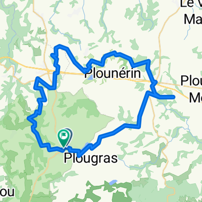
De Pen ar Yun, Plougras à Pen ar Yun, Plougras
A cycling route starting in Guerlesquin, Brittany Region, France.
Overview
About this route
- 1 h 1 min
- Duration
- 11.3 km
- Distance
- 183 m
- Ascent
- 186 m
- Descent
- 11.2 km/h
- Avg. speed
- ---
- Max. altitude

Route quality
Waytypes & surfaces along the route
Waytypes
Quiet road
8.1 km
(72 %)
Track
3.2 km
(28 %)
Undefined
-0 km
(<1 %)
Surfaces
Paved
7.8 km
(69 %)
Asphalt
7.8 km
(69 %)
Undefined
3.5 km
(31 %)
Continue with Bikemap
Use, edit, or download this cycling route
You would like to ride De Pen ar Yun, Plougras à Pen ar Yun, Plougras or customize it for your own trip? Here is what you can do with this Bikemap route:
Free features
- Save this route as favorite or in collections
- Copy & plan your own version of this route
- Sync your route with Garmin or Wahoo
Premium features
Free trial for 3 days, or one-time payment. More about Bikemap Premium.
- Navigate this route on iOS & Android
- Export a GPX / KML file of this route
- Create your custom printout (try it for free)
- Download this route for offline navigation
Discover more Premium features.
Get Bikemap PremiumFrom our community
Other popular routes starting in Guerlesquin
 Pauhlan 2
- Distance
- 140.3 km
- Ascent
- 842 m
- Descent
- 1,055 m
- Location
- Guerlesquin, Brittany Region, France
 De Hent Park ar Piz à Hent Park ar Piz
- Distance
- 43.2 km
- Ascent
- 894 m
- Descent
- 901 m
- Location
- Guerlesquin, Brittany Region, France
 plounérin
- Distance
- 10.6 km
- Ascent
- 93 m
- Descent
- 88 m
- Location
- Guerlesquin, Brittany Region, France
 D142, Guerlesquin à D42, Guerlesquin
- Distance
- 15.5 km
- Ascent
- 326 m
- Descent
- 305 m
- Location
- Guerlesquin, Brittany Region, France
 paulhan1
- Distance
- 150.9 km
- Ascent
- 686 m
- Descent
- 686 m
- Location
- Guerlesquin, Brittany Region, France
 D 42, Guerlesquin à D 42, Guerlesquin
- Distance
- 24.6 km
- Ascent
- 424 m
- Descent
- 425 m
- Location
- Guerlesquin, Brittany Region, France
 Etappe 23: Poullaouen - Saint Gerand
- Distance
- 115 km
- Ascent
- 807 m
- Descent
- 873 m
- Location
- Guerlesquin, Brittany Region, France
 Chemin de Ronde de Tro Guic, Guerlesquin à Chemin de Ronde de Tro Guic, Guerlesquin
- Distance
- 5.9 km
- Ascent
- 40 m
- Descent
- 39 m
- Location
- Guerlesquin, Brittany Region, France
Open it in the app