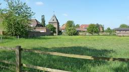
Von Raesfeld nach Krudenburg/Hünxe
A cycling route starting in Raesfeld, North Rhine-Westphalia, Germany.
Overview
About this route
The start and end point is the Hagenwiese parking lot at Raesfeld Castle. Through the animal park and along well-maintained farm roads, the route heads towards Dämmerwald and from there south via Drevenack to Krudenburg on the Lippe. Then westward following the canal to Schermbeck. (Castle, watermill). Then heading north back to Raesfeld.
- -:--
- Duration
- 41.6 km
- Distance
- 120 m
- Ascent
- 119 m
- Descent
- ---
- Avg. speed
- ---
- Max. altitude
Route quality
Waytypes & surfaces along the route
Waytypes
Quiet road
23.7 km
(57 %)
Track
6.7 km
(16 %)
Surfaces
Paved
23.7 km
(57 %)
Unpaved
12.5 km
(30 %)
Asphalt
23.3 km
(56 %)
Gravel
5.4 km
(13 %)
Route highlights
Points of interest along the route

Photo after 0.2 km
Schloss Raesfeld

Photo after 1.5 km
Forsthaus im Tiergarten

Photo after 2.6 km
Alte Wassermühle

Photo after 17.2 km
Krudenburg, Dorfstraße

Photo after 17.4 km
Brunnen

Photo after 17.4 km

Photo after 20.6 km
Wesel-Datteln-Kanal, Schleuse Hünxe

Photo after 27.2 km
Zwischen Campingplatz und Kanal

Photo after 30.5 km
Burganlage Schermbeck
Continue with Bikemap
Use, edit, or download this cycling route
You would like to ride Von Raesfeld nach Krudenburg/Hünxe or customize it for your own trip? Here is what you can do with this Bikemap route:
Free features
- Save this route as favorite or in collections
- Copy & plan your own version of this route
- Sync your route with Garmin or Wahoo
Premium features
Free trial for 3 days, or one-time payment. More about Bikemap Premium.
- Navigate this route on iOS & Android
- Export a GPX / KML file of this route
- Create your custom printout (try it for free)
- Download this route for offline navigation
Discover more Premium features.
Get Bikemap PremiumFrom our community
Other popular routes starting in Raesfeld
 Rhade Bhf - Borken Bahnhof
- Distance
- 13.6 km
- Ascent
- 31 m
- Descent
- 32 m
- Location
- Raesfeld, North Rhine-Westphalia, Germany
 Zum Golfplatz nach Reken
- Distance
- 34.4 km
- Ascent
- 94 m
- Descent
- 93 m
- Location
- Raesfeld, North Rhine-Westphalia, Germany
 Schlösser, Burgen, Herrensitze
- Distance
- 35.4 km
- Ascent
- 38 m
- Descent
- 31 m
- Location
- Raesfeld, North Rhine-Westphalia, Germany
 Raesfeld - Rhade und zurück
- Distance
- 33.5 km
- Ascent
- 116 m
- Descent
- 114 m
- Location
- Raesfeld, North Rhine-Westphalia, Germany
 Schloß Raesfeld-Marienthal-Dämmerwald
- Distance
- 25.1 km
- Ascent
- 127 m
- Descent
- 124 m
- Location
- Raesfeld, North Rhine-Westphalia, Germany
 Raesfeld - Rhede Café Kamps
- Distance
- 45.6 km
- Ascent
- 123 m
- Descent
- 124 m
- Location
- Raesfeld, North Rhine-Westphalia, Germany
 Auf der B67n (vor der Freigabe)
- Distance
- 22.4 km
- Ascent
- 60 m
- Descent
- 62 m
- Location
- Raesfeld, North Rhine-Westphalia, Germany
 Von Raesfeld nach Krudenburg/Hünxe
- Distance
- 41.6 km
- Ascent
- 120 m
- Descent
- 119 m
- Location
- Raesfeld, North Rhine-Westphalia, Germany
Open it in the app

