

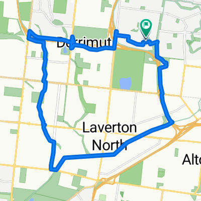
Caroline Springs - Albanvale - S/Shine Nth Loop 39k
A cycling route starting in Sunshine West, Victoria, Australia.
Overview
About this route
- -:--
- Duration
- 39.4 km
- Distance
- 128 m
- Ascent
- 124 m
- Descent
- ---
- Avg. speed
- 81 m
- Max. altitude

Route quality
Waytypes & surfaces along the route
Waytypes
Cycleway
30.7 km
(78 %)
Quiet road
5.5 km
(14 %)
Surfaces
Paved
28.7 km
(73 %)
Unpaved
1.2 km
(3 %)
Asphalt
18.5 km
(47 %)
Concrete
8.3 km
(21 %)
Continue with Bikemap
Use, edit, or download this cycling route
You would like to ride Caroline Springs - Albanvale - S/Shine Nth Loop 39k or customize it for your own trip? Here is what you can do with this Bikemap route:
Free features
- Save this route as favorite or in collections
- Copy & plan your own version of this route
- Sync your route with Garmin or Wahoo
Premium features
Free trial for 3 days, or one-time payment. More about Bikemap Premium.
- Navigate this route on iOS & Android
- Export a GPX / KML file of this route
- Create your custom printout (try it for free)
- Download this route for offline navigation
Discover more Premium features.
Get Bikemap PremiumFrom our community
Other popular routes starting in Sunshine West
 Maribyrnong River Loop 50k
- Distance
- 50.5 km
- Ascent
- 156 m
- Descent
- 152 m
- Location
- Sunshine West, Victoria, Australia
 Harvester Ward, Sunshine to 73 Batmans Hill Dr, Docklands
- Distance
- 13.7 km
- Ascent
- 76 m
- Descent
- 109 m
- Location
- Sunshine West, Victoria, Australia
 Home SW Loop 23k
- Distance
- 21.8 km
- Ascent
- 55 m
- Descent
- 53 m
- Location
- Sunshine West, Victoria, Australia
 Hm Sth Altona Loop 34k
- Distance
- 33.9 km
- Ascent
- 128 m
- Descent
- 131 m
- Location
- Sunshine West, Victoria, Australia
 ride to the park
- Distance
- 6.4 km
- Ascent
- 42 m
- Descent
- 44 m
- Location
- Sunshine West, Victoria, Australia
 Keilor Village Loop 31k
- Distance
- 30.8 km
- Ascent
- 303 m
- Descent
- 299 m
- Location
- Sunshine West, Victoria, Australia
 C/Springs - Albanvale - S/Shine Nth Loop Rvs 42k
- Distance
- 42.5 km
- Ascent
- 68 m
- Descent
- 72 m
- Location
- Sunshine West, Victoria, Australia
 Sunshine West
- Distance
- 18.4 km
- Ascent
- 47 m
- Descent
- 48 m
- Location
- Sunshine West, Victoria, Australia
Open it in the app