

Ursental - Dreifaltigkeitsberg - Bärenthal
A cycling route starting in Kolbingen, Baden-Wurttemberg, Germany.
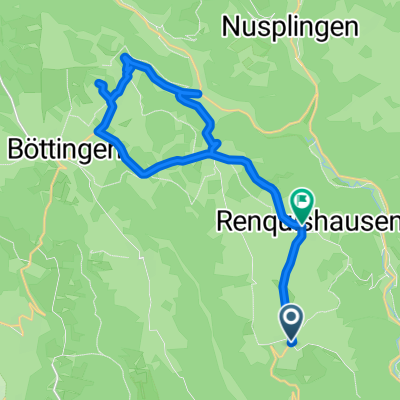
Overview
About this route
Very nice route over the Alb plateau with a breathtaking descent into Bärenthal. For the most part, the route is paved, otherwise good gravel roads. Places to stop:
- Country inn Waldeck on the Risiberg (small detour before the Jellenbrunnen rest area)
- Dreifaltigkeitsberg inn (small detour at the boundary stone)
- -:--
- Duration
- 50 km
- Distance
- 464 m
- Ascent
- 463 m
- Descent
- ---
- Avg. speed
- 982 m
- Max. altitude
Route quality
Waytypes & surfaces along the route
Waytypes
Track
34 km
(68 %)
Quiet road
12.5 km
(25 %)
Surfaces
Paved
28.5 km
(57 %)
Unpaved
19 km
(38 %)
Asphalt
25.5 km
(51 %)
Gravel
15.5 km
(31 %)
Continue with Bikemap
Use, edit, or download this cycling route
You would like to ride Ursental - Dreifaltigkeitsberg - Bärenthal or customize it for your own trip? Here is what you can do with this Bikemap route:
Free features
- Save this route as favorite or in collections
- Copy & plan your own version of this route
- Sync your route with Garmin or Wahoo
Premium features
Free trial for 3 days, or one-time payment. More about Bikemap Premium.
- Navigate this route on iOS & Android
- Export a GPX / KML file of this route
- Create your custom printout (try it for free)
- Download this route for offline navigation
Discover more Premium features.
Get Bikemap PremiumFrom our community
Other popular routes starting in Kolbingen
 Heuberg_Hegau Runde
- Distance
- 86.3 km
- Ascent
- 693 m
- Descent
- 692 m
- Location
- Kolbingen, Baden-Wurttemberg, Germany
 Kleine Heubergrunde für wenig Zeit
- Distance
- 23.8 km
- Ascent
- 425 m
- Descent
- 389 m
- Location
- Kolbingen, Baden-Wurttemberg, Germany
 Berge rund ums Donautal
- Distance
- 67.1 km
- Ascent
- 1,756 m
- Descent
- 1,772 m
- Location
- Kolbingen, Baden-Wurttemberg, Germany
 2024 - D - Tag 1 - Mühlheim - Sigmaringendorf
- Distance
- 54.5 km
- Ascent
- 1,205 m
- Descent
- 1,269 m
- Location
- Kolbingen, Baden-Wurttemberg, Germany
 Donautal- Heuberg Runde mit netten Höhen
- Distance
- 69.2 km
- Ascent
- 947 m
- Descent
- 941 m
- Location
- Kolbingen, Baden-Wurttemberg, Germany
 Runde über den großen Heuberg
- Distance
- 62.1 km
- Ascent
- 762 m
- Descent
- 762 m
- Location
- Kolbingen, Baden-Wurttemberg, Germany
 Donau-Radweg: Mühlheim-Sigmaringen CLONED FROM ROUTE 19
- Distance
- 46.9 km
- Ascent
- 288 m
- Descent
- 355 m
- Location
- Kolbingen, Baden-Wurttemberg, Germany
 Donauradweg von Sigmaringen über Donaueschingen nach Bad Dürrheim und zurück
- Distance
- 561.1 km
- Ascent
- 101 m
- Descent
- 117 m
- Location
- Kolbingen, Baden-Wurttemberg, Germany
Open it in the app