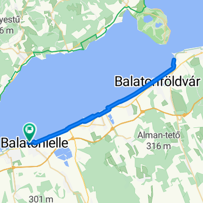
Balaton-kör
A cycling route starting in Balatonlelle, Somogy County, Hungary.
Overview
About this route
Starting from Balatonlelle towards Balatonboglár. No frills: where possible, I simplified and preferred to ride on the main road rather than going up and down the bike path.
- -:--
- Duration
- 199.7 km
- Distance
- 154 m
- Ascent
- 155 m
- Descent
- ---
- Avg. speed
- 133 m
- Max. altitude
Route quality
Waytypes & surfaces along the route
Waytypes
Cycleway
73.9 km
(37 %)
Quiet road
69.9 km
(35 %)
Surfaces
Paved
175.7 km
(88 %)
Unpaved
2 km
(1 %)
Asphalt
175.7 km
(88 %)
Unpaved (undefined)
2 km
(1 %)
Undefined
22 km
(11 %)
Continue with Bikemap
Use, edit, or download this cycling route
You would like to ride Balaton-kör or customize it for your own trip? Here is what you can do with this Bikemap route:
Free features
- Save this route as favorite or in collections
- Copy & plan your own version of this route
- Split it into stages to create a multi-day tour
- Sync your route with Garmin or Wahoo
Premium features
Free trial for 3 days, or one-time payment. More about Bikemap Premium.
- Navigate this route on iOS & Android
- Export a GPX / KML file of this route
- Create your custom printout (try it for free)
- Download this route for offline navigation
Discover more Premium features.
Get Bikemap PremiumFrom our community
Other popular routes starting in Balatonlelle
- Balaton spodaj 1x trajekt
- Distance
- 94.7 km
- Ascent
- 93 m
- Descent
- 90 m
- Location
- Balatonlelle, Somogy County, Hungary
- PBN Csapatépítő Tekerő 2. nap
- Distance
- 45.5 km
- Ascent
- 25 m
- Descent
- 21 m
- Location
- Balatonlelle, Somogy County, Hungary
- Balaton sredina 2x trajekt
- Distance
- 87.1 km
- Ascent
- 134 m
- Descent
- 134 m
- Location
- Balatonlelle, Somogy County, Hungary
- Móló sétány 3., Balatonlelle to Vásár tér 12., Keszthely
- Distance
- 48.4 km
- Ascent
- 152 m
- Descent
- 140 m
- Location
- Balatonlelle, Somogy County, Hungary
- Balaton körbetekeres
- Distance
- 209.2 km
- Ascent
- 392 m
- Descent
- 396 m
- Location
- Balatonlelle, Somogy County, Hungary
- Fogas utca 4., Balatonlelle to Fogas utca 4., Balatonlelle
- Distance
- 205.3 km
- Ascent
- 1,012 m
- Descent
- 1,012 m
- Location
- Balatonlelle, Somogy County, Hungary
- Római út, Balatonlelle - Balatonlelle
- Distance
- 6.4 km
- Ascent
- 216 m
- Descent
- 79 m
- Location
- Balatonlelle, Somogy County, Hungary
- Balatonlellei BMT túra
- Distance
- 44.9 km
- Ascent
- 471 m
- Descent
- 471 m
- Location
- Balatonlelle, Somogy County, Hungary
Open it in the app