

IT-Kos-2020-Wanderung 4/Wanderung 4
A cycling route starting in Kefalos, South Aegean, Greece.
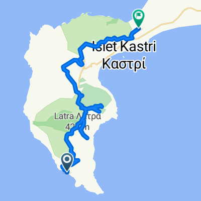
Overview
About this route
- -:--
- Duration
- 15.8 km
- Distance
- 631 m
- Ascent
- 631 m
- Descent
- ---
- Avg. speed
- 318 m
- Max. altitude

Continue with Bikemap
Use, edit, or download this cycling route
You would like to ride IT-Kos-2020-Wanderung 4/Wanderung 4 or customize it for your own trip? Here is what you can do with this Bikemap route:
Free features
- Save this route as favorite or in collections
- Copy & plan your own version of this route
- Sync your route with Garmin or Wahoo
Premium features
Free trial for 3 days, or one-time payment. More about Bikemap Premium.
- Navigate this route on iOS & Android
- Export a GPX / KML file of this route
- Create your custom printout (try it for free)
- Download this route for offline navigation
Discover more Premium features.
Get Bikemap PremiumFrom our community
Other popular routes starting in Kefalos
 Eparchiaki Odos Ko-Kefalou, Kampos to Οdos xoris onomasia, Mastichari
- Distance
- 23.1 km
- Ascent
- 268 m
- Descent
- 270 m
- Location
- Kefalos, South Aegean, Greece
 Rustgevende route in
- Distance
- 7.3 km
- Ascent
- 253 m
- Descent
- 322 m
- Location
- Kefalos, South Aegean, Greece
 kefalos 35km
- Distance
- 34.5 km
- Ascent
- 672 m
- Descent
- 671 m
- Location
- Kefalos, South Aegean, Greece
 От Οdos xoris onomasia, Onia до Греция, Kos
- Distance
- 10.4 km
- Ascent
- 140 m
- Descent
- 82 m
- Location
- Kefalos, South Aegean, Greece
 paradise beach
- Distance
- 11.2 km
- Ascent
- 682 m
- Descent
- 715 m
- Location
- Kefalos, South Aegean, Greece
 Kavo
Kavo- Distance
- 25.3 km
- Ascent
- 543 m
- Descent
- 525 m
- Location
- Kefalos, South Aegean, Greece
 Lange Radrunde durch Kefalos
- Distance
- 74.9 km
- Ascent
- 720 m
- Descent
- 721 m
- Location
- Kefalos, South Aegean, Greece
 IT-Kos-2020-Wanderung 3/Wanderung 3
- Distance
- 7.9 km
- Ascent
- 97 m
- Descent
- 93 m
- Location
- Kefalos, South Aegean, Greece
Open it in the app