

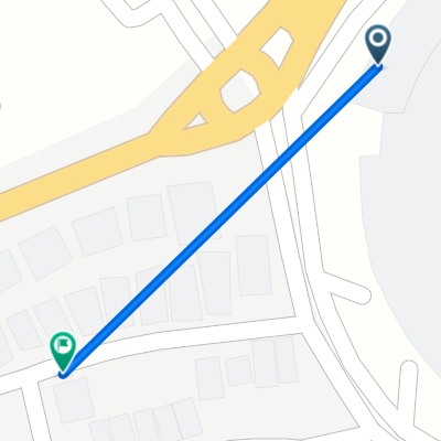
Serua, Kecamatan Ciputat to Jalan Bukit Indah 7, Kecamatan Ciputat
A cycling route starting in South Tangerang, Banten, Indonesia.
Overview
About this route
- 5 h 19 min
- Duration
- 36.8 km
- Distance
- 67 m
- Ascent
- 130 m
- Descent
- 6.9 km/h
- Avg. speed
- ---
- Max. altitude

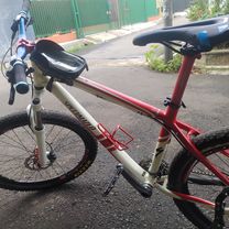
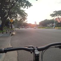
Route photos


Route quality
Waytypes & surfaces along the route
Waytypes
Quiet road
21 km
(57 %)
Track
6.6 km
(18 %)
Surfaces
Paved
8.8 km
(24 %)
Unpaved
1.1 km
(3 %)
Concrete
4.4 km
(12 %)
Asphalt
4 km
(11 %)
Continue with Bikemap
Use, edit, or download this cycling route
You would like to ride Serua, Kecamatan Ciputat to Jalan Bukit Indah 7, Kecamatan Ciputat or customize it for your own trip? Here is what you can do with this Bikemap route:
Free features
- Save this route as favorite or in collections
- Copy & plan your own version of this route
- Sync your route with Garmin or Wahoo
Premium features
Free trial for 3 days, or one-time payment. More about Bikemap Premium.
- Navigate this route on iOS & Android
- Export a GPX / KML file of this route
- Create your custom printout (try it for free)
- Download this route for offline navigation
Discover more Premium features.
Get Bikemap PremiumFrom our community
Other popular routes starting in South Tangerang
 Jalan Bulak Wangi III 16, Kecamatan Pamulang to Jalan Haji Somad/Gg. Doel 37, Kecamatan Setiabudi
- Distance
- 20 km
- Ascent
- 134 m
- Descent
- 165 m
- Location
- South Tangerang, Banten, Indonesia
 the sport of riding a mountain bike
- Distance
- 6 km
- Ascent
- 37 m
- Descent
- 34 m
- Location
- South Tangerang, Banten, Indonesia
 Gang Haji Mait to Gang Haji Mait No.18
- Distance
- 15.9 km
- Ascent
- 214 m
- Descent
- 218 m
- Location
- South Tangerang, Banten, Indonesia
 Jalan Jombang Astek 9, Kecamatan Serpong to Jalan Jombang Astek 15, Kecamatan Serpong
- Distance
- 15.6 km
- Ascent
- 89 m
- Descent
- 98 m
- Location
- South Tangerang, Banten, Indonesia
 PonPin - Bintaro - Pamulang - JPG - PonPin
- Distance
- 38.5 km
- Ascent
- 525 m
- Descent
- 525 m
- Location
- South Tangerang, Banten, Indonesia
 BSD - Dangdang - Suradita
- Distance
- 37.1 km
- Ascent
- 175 m
- Descent
- 191 m
- Location
- South Tangerang, Banten, Indonesia
 Serua, Kecamatan Ciputat to Jalan Bukit Indah 7, Kecamatan Ciputat
- Distance
- 36.8 km
- Ascent
- 67 m
- Descent
- 130 m
- Location
- South Tangerang, Banten, Indonesia
 Layanan resmi Bank DBS - Customer Service 24 Jam
- Distance
- 0.6 km
- Ascent
- 4 m
- Descent
- 0 m
- Location
- South Tangerang, Banten, Indonesia
Open it in the app