

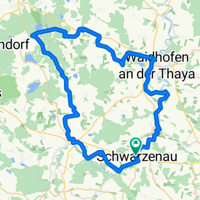
Durchs Waldviertel von Schwarzenau nach Krems
A cycling route starting in Schwarzenau, Lower Austria, Austria.
Overview
About this route
Challenging but very beautiful route from Schwarzenau, where the train from Vienna still runs, to Krems. Mostly it follows the Kamp-Thaya-March cycle path, from Krumau then along the federal road to Krems.
In total, about 1000 - 1600 meters of elevation gain must be overcome (the data varies quite a bit - see utrack analysis below), divided into many smaller or larger hills or little mountains typical for the Waldviertel. We needed 5.5 hours riding time for the route.
Here is the data analysis from utrack: Minimum elevation: 194 m above sea level Maximum elevation: 625 m above sea level Average elevation: 492.7 m above sea level Maximum difference: 431 m Total climbing: 1645 m Total descent: 1959 m Start elevation: 515 m above sea level End elevation: 201 m above sea level Final balance: -314 m
Highly recommended for ambitious riders.
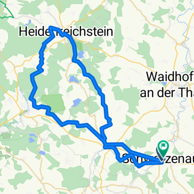
The inn at the campground in Krumau is nice and inexpensive, with seating right by the water.
- -:--
- Duration
- 95.9 km
- Distance
- 605 m
- Ascent
- 911 m
- Descent
- ---
- Avg. speed
- ---
- Max. altitude

Route quality
Waytypes & surfaces along the route
Waytypes
Road
40.3 km
(42 %)
Quiet road
16.3 km
(17 %)
Surfaces
Paved
39.3 km
(41 %)
Unpaved
3.8 km
(4 %)
Asphalt
34.5 km
(36 %)
Paved (undefined)
4.8 km
(5 %)
Continue with Bikemap
Use, edit, or download this cycling route
You would like to ride Durchs Waldviertel von Schwarzenau nach Krems or customize it for your own trip? Here is what you can do with this Bikemap route:
Free features
- Save this route as favorite or in collections
- Copy & plan your own version of this route
- Split it into stages to create a multi-day tour
- Sync your route with Garmin or Wahoo
Premium features
Free trial for 3 days, or one-time payment. More about Bikemap Premium.
- Navigate this route on iOS & Android
- Export a GPX / KML file of this route
- Create your custom printout (try it for free)
- Download this route for offline navigation
Discover more Premium features.
Get Bikemap PremiumFrom our community
Other popular routes starting in Schwarzenau
 Teiche Radroute
- Distance
- 51.1 km
- Ascent
- 422 m
- Descent
- 473 m
- Location
- Schwarzenau, Lower Austria, Austria
 Schwarzenau - Weitersfeld
- Distance
- 53.6 km
- Ascent
- 484 m
- Descent
- 556 m
- Location
- Schwarzenau, Lower Austria, Austria
 Schwarzenau - Rastenfeld Thaya-Kamp
- Distance
- 48 km
- Ascent
- 603 m
- Descent
- 627 m
- Location
- Schwarzenau, Lower Austria, Austria
 1. Tag - Kamp - Thaya - March - Radtour
- Distance
- 60.3 km
- Ascent
- 410 m
- Descent
- 509 m
- Location
- Schwarzenau, Lower Austria, Austria
 Lange Ausfahrt durch Gemeinde Echsenbach
- Distance
- 53.4 km
- Ascent
- 440 m
- Descent
- 394 m
- Location
- Schwarzenau, Lower Austria, Austria
 Schwarzenau - Melk 2021
- Distance
- 99.8 km
- Ascent
- 828 m
- Descent
- 1,103 m
- Location
- Schwarzenau, Lower Austria, Austria
 Teichgasse, Schwarzenau nach Wiesengasse, Schwarzenau
- Distance
- 56 km
- Ascent
- 513 m
- Descent
- 507 m
- Location
- Schwarzenau, Lower Austria, Austria
 Schwarzenau - Drosendorf (Kamp-Thaya-March 1)
- Distance
- 64.6 km
- Ascent
- 460 m
- Descent
- 583 m
- Location
- Schwarzenau, Lower Austria, Austria
Open it in the app