

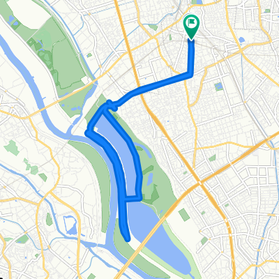
荒川下りコース
A cycling route starting in Yono, Saitama, Japan.
Overview
About this route
- 2 h 35 min
- Duration
- 42.1 km
- Distance
- 628 m
- Ascent
- 628 m
- Descent
- 16.3 km/h
- Avg. speed
- ---
- Max. altitude

Route quality
Waytypes & surfaces along the route
Waytypes
Cycleway
28.2 km
(67 %)
Quiet road
2.5 km
(6 %)
Surfaces
Paved
14.3 km
(34 %)
Paved (undefined)
9.7 km
(23 %)
Asphalt
4.6 km
(11 %)
Undefined
27.8 km
(66 %)
Continue with Bikemap
Use, edit, or download this cycling route
You would like to ride 荒川下りコース or customize it for your own trip? Here is what you can do with this Bikemap route:
Free features
- Save this route as favorite or in collections
- Copy & plan your own version of this route
- Sync your route with Garmin or Wahoo
Premium features
Free trial for 3 days, or one-time payment. More about Bikemap Premium.
- Navigate this route on iOS & Android
- Export a GPX / KML file of this route
- Create your custom printout (try it for free)
- Download this route for offline navigation
Discover more Premium features.
Get Bikemap PremiumFrom our community
Other popular routes starting in Yono
 緑のヘルシーロード
- Distance
- 54.5 km
- Ascent
- 199 m
- Descent
- 228 m
- Location
- Yono, Saitama, Japan
 Zaike, Sakura, Saitama to 413-1, Arai 2-Chōme, Kitamoto
- Distance
- 22.8 km
- Ascent
- 327 m
- Descent
- 307 m
- Location
- Yono, Saitama, Japan
 鹿手袋3丁目, さいたま市へ鹿手袋3丁目, さいたま市
- Distance
- 29.8 km
- Ascent
- 94 m
- Descent
- 92 m
- Location
- Yono, Saitama, Japan
 Urawa to Kawagoe Long
- Distance
- 30.6 km
- Ascent
- 51 m
- Descent
- 39 m
- Location
- Yono, Saitama, Japan
 Yono, Saitama <> Tama Lake
- Distance
- 30.3 km
- Ascent
- 328 m
- Descent
- 233 m
- Location
- Yono, Saitama, Japan
 4丁目, さいたま市 まで2丁目 9, 上尾市
- Distance
- 12.7 km
- Ascent
- 3 m
- Descent
- 39 m
- Location
- Yono, Saitama, Japan
 21-12, Shimoochiai 2-Chōme, Chuo, Saitama to 721, Yamata, Namegawa, Hiki-Gun
- Distance
- 41.5 km
- Ascent
- 100 m
- Descent
- 45 m
- Location
- Yono, Saitama, Japan
 Saitama Green Healthy Road - North
- Distance
- 15 km
- Ascent
- 63 m
- Descent
- 64 m
- Location
- Yono, Saitama, Japan
Open it in the app