Stegen - Schauinsland - Stegen
A cycling route starting in Stegen, Baden-Württemberg, Germany.
Overview
About this route
- -:--
- Duration
- 44.7 km
- Distance
- 946 m
- Ascent
- 944 m
- Descent
- ---
- Avg. speed
- ---
- Avg. speed
Route quality
Waytypes & surfaces along the route
Waytypes
Busy road
21.5 km
(48 %)
Road
9.2 km
(21 %)
Surfaces
Paved
44.1 km
(99 %)
Unpaved
0 km
(<1 %)
Asphalt
43.6 km
(97 %)
Paved (undefined)
0.3 km
(<1 %)
Continue with Bikemap
Use, edit, or download this cycling route
You would like to ride Stegen - Schauinsland - Stegen or customize it for your own trip? Here is what you can do with this Bikemap route:
Free features
- Save this route as favorite or in collections
- Copy & plan your own version of this route
- Sync your route with Garmin or Wahoo
Premium features
Free trial for 3 days, or one-time payment. More about Bikemap Premium.
- Navigate this route on iOS & Android
- Export a GPX / KML file of this route
- Create your custom printout (try it for free)
- Download this route for offline navigation
Discover more Premium features.
Get Bikemap PremiumFrom our community
Other popular routes starting in Stegen
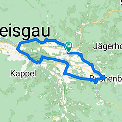
- attental-st.peter = kurze knackige trainingsstrecke
- Distance
- 25.7 km
- Ascent
- 629 m
- Descent
- 600 m
- Location
- Stegen, Baden-Württemberg, Germany
- ebnet-windräder
- Distance
- 8.6 km
- Ascent
- 579 m
- Descent
- 292 m
- Location
- Stegen, Baden-Württemberg, Germany
- attental-kandel = mittelschwere bergetappe im südschwarzwald
- Distance
- 87.2 km
- Ascent
- 2,197 m
- Descent
- 1,919 m
- Location
- Stegen, Baden-Württemberg, Germany
- Zur Zähringer Burg
- Distance
- 31.2 km
- Ascent
- 692 m
- Descent
- 698 m
- Location
- Stegen, Baden-Württemberg, Germany
- Stegen - Schauinsland - Stegen
- Distance
- 44.7 km
- Ascent
- 946 m
- Descent
- 944 m
- Location
- Stegen, Baden-Württemberg, Germany
- 2016-03_14 Runde durch die Ortenau
- Distance
- 150.5 km
- Ascent
- 814 m
- Descent
- 814 m
- Location
- Stegen, Baden-Württemberg, Germany
- Schulstiftungs-Brevet
- Distance
- 626.4 km
- Ascent
- 2,071 m
- Descent
- 2,071 m
- Location
- Stegen, Baden-Württemberg, Germany
- Stegen-Rappenecker Hütter-Kirchzarten
- Distance
- 18.9 km
- Ascent
- 704 m
- Descent
- 708 m
- Location
- Stegen, Baden-Württemberg, Germany
Open it in the app