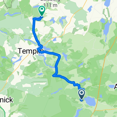
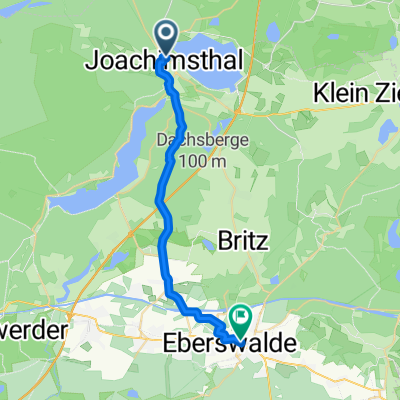
Barnim Tour
A cycling route starting in Joachimsthal, Brandenburg, Germany.
Overview
About this route
- -:--
- Duration
- 70.3 km
- Distance
- 256 m
- Ascent
- 256 m
- Descent
- ---
- Avg. speed
- ---
- Avg. speed
Route quality
Waytypes & surfaces along the route
Waytypes
Quiet road
29.4 km
(42 %)
Track
17 km
(24 %)
Surfaces
Paved
43 km
(61 %)
Unpaved
17.5 km
(25 %)
Asphalt
32.6 km
(46 %)
Ground
8 km
(11 %)
Route highlights
Points of interest along the route
Photo after 0.9 km
Photo after 3.3 km
Photo after 4.1 km
Photo after 5.9 km
Photo after 8.4 km
Photo after 8.9 km
Photo after 8.9 km
Photo after 8.9 km
Photo after 9.3 km
Photo after 10 km
Photo after 12.4 km
Photo after 13.3 km
Photo after 13.8 km
Photo after 14.6 km
Photo after 15.5 km
Photo after 16.1 km
Photo after 16.2 km
Photo after 16.4 km
Photo after 16.6 km
Photo after 16.7 km
Photo after 17.1 km
Photo after 17.4 km
Photo after 19.5 km
Photo after 20 km
Photo after 20.7 km
Photo after 21.4 km
Photo after 21.8 km
Photo after 22.7 km
Photo after 25.2 km
Photo after 25.5 km
Photo after 25.7 km
Photo after 26.1 km
Photo after 26.1 km
Photo after 26.5 km
Photo after 26.6 km
Photo after 26.6 km
Photo after 26.6 km
Photo after 27.1 km
Photo after 27.3 km
Photo after 28.4 km
Photo after 29.1 km
Photo after 29.7 km
Photo after 32 km
Photo after 32.3 km
Photo after 33 km
Photo after 33.7 km
Photo after 33.8 km
Photo after 34.5 km
Photo after 35.1 km
Photo after 35.7 km
Photo after 36 km
Photo after 36.5 km
Photo after 36.6 km
Photo after 37.2 km
Photo after 38 km
Photo after 39.7 km
Photo after 39.9 km
Photo after 40.8 km
Photo after 41.6 km
Photo after 41.7 km
Photo after 43.5 km
Photo after 43.9 km
Photo after 44.2 km
Photo after 46.7 km
Photo after 47.1 km
Photo after 47.8 km
Photo after 49 km
Photo after 49 km
Photo after 49.3 km
Photo after 51.3 km
Photo after 52.5 km
Photo after 52.9 km
Photo after 54.6 km
Photo after 55.9 km
Photo after 57.5 km
Photo after 58.5 km
Photo after 58.6 km
Photo after 58.7 km
Photo after 58.9 km
Photo after 59.3 km
Photo after 60.3 km
Photo after 61.3 km
Photo after 61.4 km
Photo after 61.6 km
Photo after 64.7 km
Photo after 64.9 km
Photo after 65.3 km
Photo after 65.8 km
Continue with Bikemap
Use, edit, or download this cycling route
You would like to ride Barnim Tour or customize it for your own trip? Here is what you can do with this Bikemap route:
Free features
- Save this route as favorite or in collections
- Copy & plan your own version of this route
- Sync your route with Garmin or Wahoo
Premium features
Free trial for 3 days, or one-time payment. More about Bikemap Premium.
- Navigate this route on iOS & Android
- Export a GPX / KML file of this route
- Create your custom printout (try it for free)
- Download this route for offline navigation
Discover more Premium features.
Get Bikemap PremiumFrom our community
Other popular routes starting in Joachimsthal
- Joachimsthal Angermünde Chorin
- Distance
- 87.3 km
- Ascent
- 243 m
- Descent
- 243 m
- Location
- Joachimsthal, Brandenburg, Germany
- 20170614_175027.gpx
- Distance
- 15.6 km
- Ascent
- 70 m
- Descent
- 67 m
- Location
- Joachimsthal, Brandenburg, Germany
- Werbellinsee Waldstrecke
- Distance
- 30.3 km
- Ascent
- 232 m
- Descent
- 232 m
- Location
- Joachimsthal, Brandenburg, Germany
- Grimnitzsee große Runde
- Distance
- 29.1 km
- Ascent
- 170 m
- Descent
- 171 m
- Location
- Joachimsthal, Brandenburg, Germany
- tour durch die uckermark
- Distance
- 119.4 km
- Ascent
- 205 m
- Descent
- 204 m
- Location
- Joachimsthal, Brandenburg, Germany
- Barnim Tour
- Distance
- 70.3 km
- Ascent
- 256 m
- Descent
- 256 m
- Location
- Joachimsthal, Brandenburg, Germany
- 11. Joachimsthal - Berlin
- Distance
- 75.3 km
- Ascent
- 132 m
- Descent
- 177 m
- Location
- Joachimsthal, Brandenburg, Germany
- Rund um den Werbellinsee
- Distance
- 26.5 km
- Ascent
- 206 m
- Descent
- 206 m
- Location
- Joachimsthal, Brandenburg, Germany