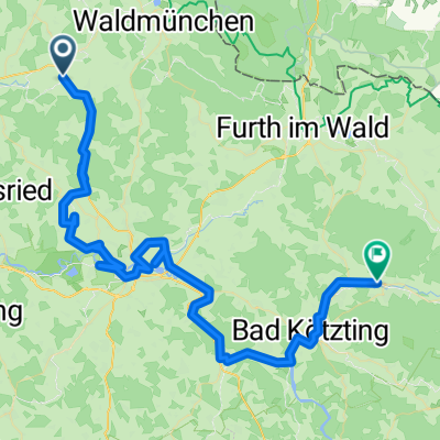
Hausrunde Döfering - Gleissenberg
A cycling route starting in Schönthal, Bavaria, Germany.
Overview
About this route
eine meiner Hausrunden mit 2-3 schönen Anstiegen für MTB sehr gut geeignet.
- -:--
- Duration
- 36.2 km
- Distance
- 680 m
- Ascent
- 680 m
- Descent
- ---
- Avg. speed
- ---
- Avg. speed
Route quality
Waytypes & surfaces along the route
Waytypes
Quiet road
16.7 km
(46 %)
Track
8.8 km
(24 %)
Surfaces
Paved
9.9 km
(27 %)
Unpaved
9.4 km
(26 %)
Asphalt
9.9 km
(27 %)
Gravel
6.8 km
(19 %)
Continue with Bikemap
Use, edit, or download this cycling route
You would like to ride Hausrunde Döfering - Gleissenberg or customize it for your own trip? Here is what you can do with this Bikemap route:
Free features
- Save this route as favorite or in collections
- Copy & plan your own version of this route
- Sync your route with Garmin or Wahoo
Premium features
Free trial for 3 days, or one-time payment. More about Bikemap Premium.
- Navigate this route on iOS & Android
- Export a GPX / KML file of this route
- Create your custom printout (try it for free)
- Download this route for offline navigation
Discover more Premium features.
Get Bikemap PremiumFrom our community
Other popular routes starting in Schönthal
- Moderate Route in Schönthal
- Distance
- 0.1 km
- Ascent
- 4 m
- Descent
- 0 m
- Location
- Schönthal, Bavaria, Germany
- Einfache Fahrt in Neunburg vorm Wald
- Distance
- 24.4 km
- Ascent
- 205 m
- Descent
- 292 m
- Location
- Schönthal, Bavaria, Germany
- Rhaner Zell 18, Schönthal nach Rhaner Zell 18, Schönthal
- Distance
- 24 km
- Ascent
- 341 m
- Descent
- 341 m
- Location
- Schönthal, Bavaria, Germany
- Route nach Thurau 10, Schönthal
- Distance
- 10.5 km
- Ascent
- 68 m
- Descent
- 65 m
- Location
- Schönthal, Bavaria, Germany
- Mariabad 1
- Distance
- 105.2 km
- Ascent
- 1,328 m
- Descent
- 1,276 m
- Location
- Schönthal, Bavaria, Germany
- Route nach Thurau 10, Schönthal
- Distance
- 5.6 km
- Ascent
- 34 m
- Descent
- 31 m
- Location
- Schönthal, Bavaria, Germany
- Eixendorfer see
- Distance
- 41 km
- Ascent
- 227 m
- Descent
- 224 m
- Location
- Schönthal, Bavaria, Germany
- Trans Bayerwald Südroute Etappe 1
- Distance
- 39 km
- Ascent
- 1,075 m
- Descent
- 1,129 m
- Location
- Schönthal, Bavaria, Germany
Open it in the app