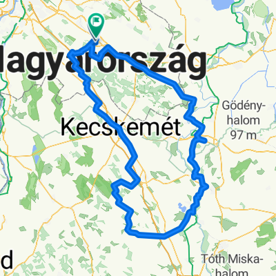
2011.05.12. Pánd kerülő Singivel
- 34.3 km
- 208 m
- 206 m
- Pilis, Pest County, Hungary
A cycling route starting in Pilis, Pest County, Hungary.
Overview
Fel a kilátóhoz 228 m magas (állítólag az Alföldön Nyíregyházáig a legmagasabb pont). Onnan ki a Bicskei útra egészen Pánd vonaláig. Pándon keresztül Káva felé majd egy balossal a Pándi úton vissza Pilisre.
created this 14 years ago
Route quality
Track
26.1 km
(76 %)
Quiet road
4.1 km
(12 %)
Paved
3.8 km
(11 %)
Unpaved
19.6 km
(57 %)
Ground
10.6 km
(31 %)
Gravel
7.9 km
(23 %)
Continue with Bikemap
You would like to ride 2011.05.12. Pánd kerülő Singivel or customize it for your own trip? Here is what you can do with this Bikemap route:
Free trial for 3 days, or one-time payment. More about Bikemap Premium.
Discover more Premium features.
Get Bikemap PremiumFrom our community
Open it in the app