

Neustädter Runde
A cycling route starting in Langenwetzendorf, Thuringia, Germany.
Overview
About this route
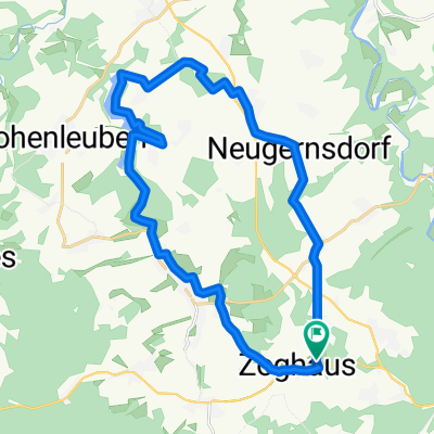
Nice loop with a double passage of the Zeulenroda reservoir, initially open and partly wind-exposed terrain, after Neustadt it then goes into the forest and after the Tröbnitz turn through a gentle valley towards the A9 (good time trial training terrain), the terrain offers moderate climbs with two or three small ramps (e.g., from Wöhlsdorf to Piesigitz). For those who still want to push themselves, turn left in Wöhlsdorf towards Staitz, then continue towards Triebes via the Dörtendorf "Hanka-Berg" – which is used annually in the Thüringen Ladies Tour). However, this is not a problem for any well-trained cyclist. Tip: then head for an isotonic cold drink in the beer garden of the Seehotel Zeulenroda. Access via the Waikiki turnoff, behind the Bauerfeind Tower. Riding time approx. 3.5h
- -:--
- Duration
- 103 km
- Distance
- 804 m
- Ascent
- 802 m
- Descent
- ---
- Avg. speed
- ---
- Max. altitude

Route quality
Waytypes & surfaces along the route
Waytypes
Road
21.6 km
(21 %)
Quiet road
3.1 km
(3 %)
Surfaces
Paved
69 km
(67 %)
Asphalt
69 km
(67 %)
Undefined
34 km
(33 %)
Continue with Bikemap
Use, edit, or download this cycling route
You would like to ride Neustädter Runde or customize it for your own trip? Here is what you can do with this Bikemap route:
Free features
- Save this route as favorite or in collections
- Copy & plan your own version of this route
- Split it into stages to create a multi-day tour
- Sync your route with Garmin or Wahoo
Premium features
Free trial for 3 days, or one-time payment. More about Bikemap Premium.
- Navigate this route on iOS & Android
- Export a GPX / KML file of this route
- Create your custom printout (try it for free)
- Download this route for offline navigation
Discover more Premium features.
Get Bikemap PremiumFrom our community
Other popular routes starting in Langenwetzendorf
 NAI TALSPERRE ZR NAI
- Distance
- 48.5 km
- Ascent
- 333 m
- Descent
- 334 m
- Location
- Langenwetzendorf, Thuringia, Germany
 Pfingsten
- Distance
- 23.1 km
- Ascent
- 274 m
- Descent
- 277 m
- Location
- Langenwetzendorf, Thuringia, Germany
 Zeule
Zeule- Distance
- 38.5 km
- Ascent
- 412 m
- Descent
- 418 m
- Location
- Langenwetzendorf, Thuringia, Germany
 Kleine Kirchberger Runde
- Distance
- 132.7 km
- Ascent
- 1,101 m
- Descent
- 1,101 m
- Location
- Langenwetzendorf, Thuringia, Germany
 Von Nai nach Weißenfels
- Distance
- 78.5 km
- Ascent
- 255 m
- Descent
- 469 m
- Location
- Langenwetzendorf, Thuringia, Germany
 Neustädter Runde
- Distance
- 103 km
- Ascent
- 804 m
- Descent
- 802 m
- Location
- Langenwetzendorf, Thuringia, Germany
 Elsterradweg von Naitschau aus
- Distance
- 148 km
- Ascent
- 229 m
- Descent
- 514 m
- Location
- Langenwetzendorf, Thuringia, Germany
 Langenwetzendorf - Wünschendorf
- Distance
- 17.1 km
- Ascent
- 195 m
- Descent
- 318 m
- Location
- Langenwetzendorf, Thuringia, Germany
Open it in the app