

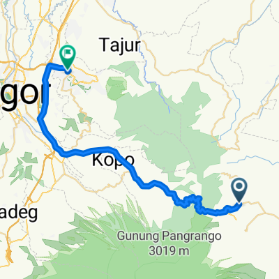
Jalan Gunung Putri 02/08, Kecamatan Pacet to Unnamed Road, Kecamatan Mande
A cycling route starting in Cianjur, West Java, Indonesia.
Overview
About this route
- 5 h 42 min
- Duration
- 30.6 km
- Distance
- 388 m
- Ascent
- 1,393 m
- Descent
- 5.4 km/h
- Avg. speed
- ---
- Max. altitude

Route photos


Continue with Bikemap
Use, edit, or download this cycling route
You would like to ride Jalan Gunung Putri 02/08, Kecamatan Pacet to Unnamed Road, Kecamatan Mande or customize it for your own trip? Here is what you can do with this Bikemap route:
Free features
- Save this route as favorite or in collections
- Copy & plan your own version of this route
- Sync your route with Garmin or Wahoo
Premium features
Free trial for 3 days, or one-time payment. More about Bikemap Premium.
- Navigate this route on iOS & Android
- Export a GPX / KML file of this route
- Create your custom printout (try it for free)
- Download this route for offline navigation
Discover more Premium features.
Get Bikemap PremiumFrom our community
Other popular routes starting in Cianjur
 Jalan Halteu Maleber 52, Karangtengah to Jalan Halteu Maleber 52, Karangtengah
- Distance
- 6.5 km
- Ascent
- 35 m
- Descent
- 74 m
- Location
- Cianjur, West Java, Indonesia
 Cisarua-Bandung-Indonesia
- Distance
- 113.8 km
- Ascent
- 1,474 m
- Descent
- 1,974 m
- Location
- Cianjur, West Java, Indonesia
 kota bunga sentul
- Distance
- 42.9 km
- Ascent
- 486 m
- Descent
- 1,302 m
- Location
- Cianjur, West Java, Indonesia
 Pjok 1
- Distance
- 17.8 km
- Ascent
- 193 m
- Descent
- 199 m
- Location
- Cianjur, West Java, Indonesia
 Cianjur Cycling
- Distance
- 129 km
- Ascent
- 1,974 m
- Descent
- 1,964 m
- Location
- Cianjur, West Java, Indonesia
 Java-Bali 02, Indonesia, Cipanas - Garut, 149
- Distance
- 149.3 km
- Ascent
- 1,063 m
- Descent
- 1,456 m
- Location
- Cianjur, West Java, Indonesia
 Jalan Cigalumpit Regency 23, Karangtengah to Jalan Halteu Maleber 52, Karangtengah
- Distance
- 18.3 km
- Ascent
- 214 m
- Descent
- 234 m
- Location
- Cianjur, West Java, Indonesia
 Gunung Padang (mini loop)
- Distance
- 61.4 km
- Ascent
- 789 m
- Descent
- 789 m
- Location
- Cianjur, West Java, Indonesia
Open it in the app