Tour de Wade - Harz KA Training
- 80.6 km
- 1,095 m
- 1,002 m
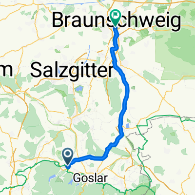
- Langelsheim, Lower Saxony, Germany
A cycling route starting in Langelsheim, Lower Saxony, Germany.
Overview
created this 14 years ago
Route quality
Path
42.7 km
(25 %)
Quiet road
27.3 km
(16 %)
Paved
109.3 km
(64 %)
Unpaved
3.4 km
(2 %)
Asphalt
102.5 km
(60 %)
Paved (undefined)
5.1 km
(3 %)
Route highlights
http://www.camping-lippstadt.de/
Continue with Bikemap
You would like to ride 3.Etappe or customize it for your own trip? Here is what you can do with this Bikemap route:
Free trial for 3 days, or one-time payment. More about Bikemap Premium.
Discover more Premium features.
Get Bikemap PremiumFrom our community
Open it in the app