
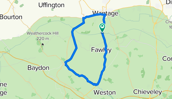
Lambourn and shefford loop
A cycling route starting in Wantage, England, United Kingdom.
Overview
About this route
- 1 h 55 min
- Duration
- 34.6 km
- Distance
- 516 m
- Ascent
- 516 m
- Descent
- 18 km/h
- Avg. speed
- ---
- Max. altitude

Route quality
Waytypes & surfaces along the route
Waytypes
Busy road
21.5 km
(62 %)
Road
6 km
(17 %)
Surfaces
Paved
34.3 km
(99 %)
Unpaved
0 km
(<1 %)
Asphalt
33.6 km
(97 %)
Concrete
0.7 km
(2 %)
Continue with Bikemap
Use, edit, or download this cycling route
You would like to ride Lambourn and shefford loop or customize it for your own trip? Here is what you can do with this Bikemap route:
Free features
- Save this route as favorite or in collections
- Copy & plan your own version of this route
- Sync your route with Garmin or Wahoo
Premium features
Free trial for 3 days, or one-time payment. More about Bikemap Premium.
- Navigate this route on iOS & Android
- Export a GPX / KML file of this route
- Create your custom printout (try it for free)
- Download this route for offline navigation
Discover more Premium features.
Get Bikemap PremiumFrom our community
Other popular routes starting in Wantage
 Letcombe Trail Ride Feb 11
- Distance
- 44.8 km
- Ascent
- 508 m
- Descent
- 507 m
- Location
- Wantage, England, United Kingdom
 Hilly Challow–Lambourn–Shrivenham
- Distance
- 67.7 km
- Ascent
- 457 m
- Descent
- 458 m
- Location
- Wantage, England, United Kingdom
 Chain Hill and 1/2way to Farnbrough
- Distance
- 7.1 km
- Ascent
- 94 m
- Descent
- 96 m
- Location
- Wantage, England, United Kingdom
 Newbury Street 9 to The Steadings 12, Royal Wootton Bassett
- Distance
- 51 km
- Ascent
- 347 m
- Descent
- 320 m
- Location
- Wantage, England, United Kingdom
 Grove Hanney Denchworth
- Distance
- 15.8 km
- Ascent
- 72 m
- Descent
- 72 m
- Location
- Wantage, England, United Kingdom
 Ickneild Way to Reading Road 2, West Hendred
- Distance
- 15.5 km
- Ascent
- 149 m
- Descent
- 206 m
- Location
- Wantage, England, United Kingdom
 Short Hill Loop
- Distance
- 41.8 km
- Ascent
- 516 m
- Descent
- 516 m
- Location
- Wantage, England, United Kingdom
 Post Office Bungalow, High St, Wantage to Kite House, Aston St, Didcot
- Distance
- 17 km
- Ascent
- 89 m
- Descent
- 129 m
- Location
- Wantage, England, United Kingdom
Open it in the app