![[Trek] V 52 - La véloroute de la Marne](/_next/static/media/contour-lines-light-small.cafd5e5d.avif)
![[Trek] V 52 - La véloroute de la Marne](https://media.bikemap.net/routes/9775768/staticmaps/in_6fe7cd34-87dc-4960-9d1b-26e368a8f1eb_694x400_bikemap-2021-3D-static.png)
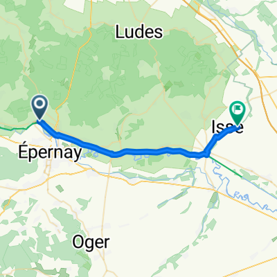
[Trek] V 52 - La véloroute de la Marne
A cycling route starting in Dizy, Grand Est, France.
Overview
About this route
From Dormans to Epernay, Marne flows between the foothills of the Montagne de Reims and the Côte des Blancs, which marks the eastern border of the Paris basin. in the wait of a new greenway to be developed, the route follows a section on preliminary automobile roads. The surrounding land fades gradually as we approach Chalons-en-Champagne. From the boat cruise you can see the "Venise Pétillante" before arriving to Vitry-le-François to follow a temporary route on a low traffic road.
Modified: 23 weeks ago
- -:--
- Duration
- 22.8 km
- Distance
- 25 m
- Ascent
- 18 m
- Descent
- ---
- Avg. speed
- 78 m
- Max. altitude

Route quality
Waytypes & surfaces along the route
Waytypes
Path
8.7 km
(38 %)
Cycleway
8.7 km
(38 %)
Surfaces
Paved
17 km
(75 %)
Unpaved
0.6 km
(3 %)
Asphalt
15.7 km
(69 %)
Concrete
1.2 km
(5 %)
Continue with Bikemap
Use, edit, or download this cycling route
You would like to ride [Trek] V 52 - La véloroute de la Marne or customize it for your own trip? Here is what you can do with this Bikemap route:
Free features
- Save this route as favorite or in collections
- Copy & plan your own version of this route
- Sync your route with Garmin or Wahoo
Premium features
Free trial for 3 days, or one-time payment. More about Bikemap Premium.
- Navigate this route on iOS & Android
- Export a GPX / KML file of this route
- Create your custom printout (try it for free)
- Download this route for offline navigation
Discover more Premium features.
Get Bikemap PremiumFrom our community
Other popular routes starting in Dizy
 Cracking ride in Saint-Imoges
- Distance
- 51.9 km
- Ascent
- 521 m
- Descent
- 681 m
- Location
- Dizy, Grand Est, France
 Hautvillers
- Distance
- 35.6 km
- Ascent
- 514 m
- Descent
- 511 m
- Location
- Dizy, Grand Est, France
![[Trek] V 52 - La véloroute de la Marne](https://media.bikemap.net/routes/9775768/staticmaps/in_6fe7cd34-87dc-4960-9d1b-26e368a8f1eb_400x400_bikemap-2021-3D-static.png) [Trek] V 52 - La véloroute de la Marne
[Trek] V 52 - La véloroute de la Marne- Distance
- 22.8 km
- Ascent
- 25 m
- Descent
- 18 m
- Location
- Dizy, Grand Est, France
 Dizy naar Place de l'Hôtel de ville 1, Reims
- Distance
- 28 km
- Ascent
- 388 m
- Descent
- 368 m
- Location
- Dizy, Grand Est, France
 Moderate route in Vaudemange
- Distance
- 24.9 km
- Ascent
- 1,473 m
- Descent
- 1,472 m
- Location
- Dizy, Grand Est, France
 Paris - Straßburg Tag 3
- Distance
- 95.9 km
- Ascent
- 64 m
- Descent
- 0 m
- Location
- Dizy, Grand Est, France
 12345
12345- Distance
- 1.2 km
- Ascent
- 0 m
- Descent
- 0 m
- Location
- Dizy, Grand Est, France
 Champagne I
- Distance
- 63.2 km
- Ascent
- 948 m
- Descent
- 951 m
- Location
- Dizy, Grand Est, France
Open it in the app