

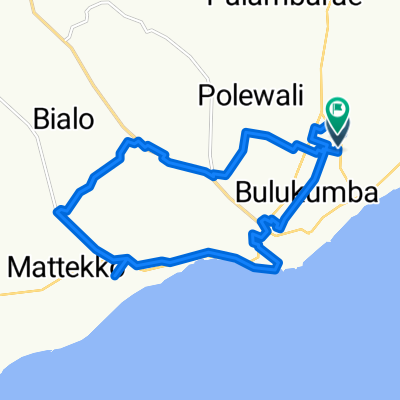
Desa Taccorong,Desa Bialo,Desa Dampang,Desa Bontomacinna,Ponre,Jln Sultan Hasanuddin
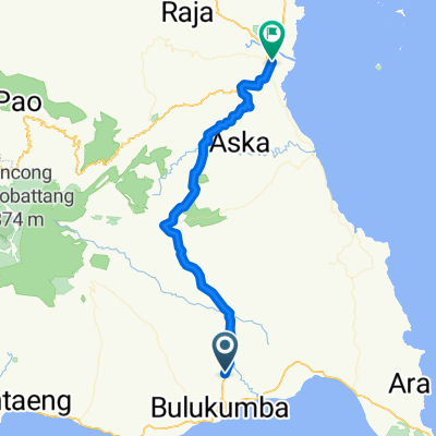
A cycling route starting in Bulukumba, South Sulawesi, Indonesia.
Overview
About this route
- 1 h 18 min
- Duration
- 26.1 km
- Distance
- 90 m
- Ascent
- 59 m
- Descent
- 20 km/h
- Avg. speed
- ---
- Max. altitude

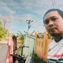
Route photos


Route quality
Waytypes & surfaces along the route
Waytypes
Road
6.8 km
(26 %)
Quiet road
6.3 km
(24 %)
Continue with Bikemap
Use, edit, or download this cycling route
You would like to ride Desa Taccorong,Desa Bialo,Desa Dampang,Desa Bontomacinna,Ponre,Jln Sultan Hasanuddin or customize it for your own trip? Here is what you can do with this Bikemap route:
Free features
- Save this route as favorite or in collections
- Copy & plan your own version of this route
- Sync your route with Garmin or Wahoo
Premium features
Free trial for 3 days, or one-time payment. More about Bikemap Premium.
- Navigate this route on iOS & Android
- Export a GPX / KML file of this route
- Create your custom printout (try it for free)
- Download this route for offline navigation
Discover more Premium features.
Get Bikemap PremiumFrom our community
Other popular routes starting in Bulukumba
 Bulukumba
- Distance
- 22.1 km
- Ascent
- 73 m
- Descent
- 74 m
- Location
- Bulukumba, South Sulawesi, Indonesia
 SEPEDA
- Distance
- 6.5 km
- Ascent
- 60 m
- Descent
- 60 m
- Location
- Bulukumba, South Sulawesi, Indonesia
 Bulukumba - Sinjai
- Distance
- 63.1 km
- Ascent
- 688 m
- Descent
- 726 m
- Location
- Bulukumba, South Sulawesi, Indonesia
 Jalan Sam Ratulangi 1, Ujung Bulu to Jalan Anggrek 9, Ujung Bulu
- Distance
- 20 km
- Ascent
- 155 m
- Descent
- 157 m
- Location
- Bulukumba, South Sulawesi, Indonesia
 Jalan Kusuma Bangsa to Jalan Kusuma Bangsa
- Distance
- 22.1 km
- Ascent
- 74 m
- Descent
- 75 m
- Location
- Bulukumba, South Sulawesi, Indonesia
 Route to Jalan Kusuma Bangsa No.79
- Distance
- 171.2 km
- Ascent
- 3,615 m
- Descent
- 3,663 m
- Location
- Bulukumba, South Sulawesi, Indonesia
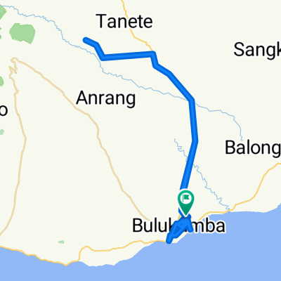
 Kusuma Bangsa - Desa Polewali - Bukit Tinggi - Bontosungguh - Kota
- Distance
- 16.3 km
- Ascent
- 78 m
- Descent
- 134 m
- Location
- Bulukumba, South Sulawesi, Indonesia
 Desa Taccorong,Desa Bialo,Desa Dampang,Desa Bontomacinna,Ponre,Jln Sultan Hasanuddin
- Distance
- 26.1 km
- Ascent
- 90 m
- Descent
- 59 m
- Location
- Bulukumba, South Sulawesi, Indonesia
Open it in the app