

"Col de la Wickersrode" (Geg.Uhrz.)
- 21.6 km
- 298 m
- 298 m
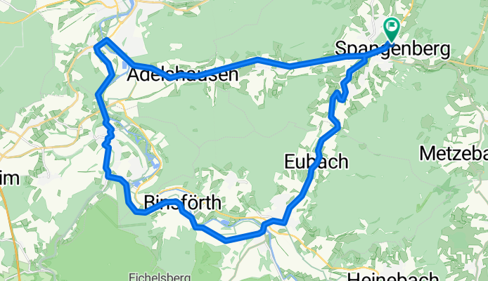
- Spangenberg, Hesse, Germany
A cycling route starting in Spangenberg, Hesse, Germany.
Overview
Difficulties:
The main climb, 'Schmachtenhagen' between Morschen and Spangenberg, has about 140 m of elevation gain from the exit of Morschen over a distance of 2.4 km. This means an average gradient of around 5.8 %. The gradient is irregular: shortly after Morschen it rises moderately, then barely rises until Eubach, only to become moderately steeper again after Eubach. It only gets significantly steeper towards the end: the last 400 m are continuously steeper up to 8-9 %.
However, the rest of the route is not completely flat, as more than half of the total 370 m of elevation gain is distributed over short climbs that can also be quite taxing on the legs (for example, there is a short section behind Beiseförth with > 13% gradient...).
Best roads, only slightly bumpy in the first meters of the descent from Schmachtenhagen.
Little traffic, there may also be trucks on the B478. However, these can be avoided:
Variants: bike path between Spangenberg and Morschen (highly recommended) and bike path between Malsfeld and Beiseförth (boring - but saves you the detour over the little hill on the K29)
created this 14 years ago
Route quality
Road
8.9 km
(29 %)
Track
3.1 km
(10 %)
Paved
24.9 km
(81 %)
Unpaved
3.1 km
(10 %)
Asphalt
24.6 km
(80 %)
Gravel
2.2 km
(7 %)
Continue with Bikemap
You would like to ride "Ronde van Schmachtenhagen" (Geg. Uhrz.) or customize it for your own trip? Here is what you can do with this Bikemap route:
Free trial for 3 days, or one-time payment. More about Bikemap Premium.
Discover more Premium features.
Get Bikemap PremiumFrom our community
Open it in the app


