

Alter Post weg nach Cochem
A cycling route starting in Landkern, Rhineland-Palatinate, Germany.
Overview
About this route
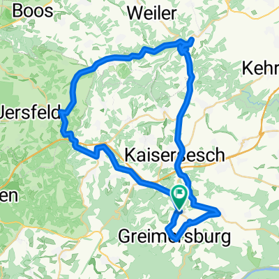
It's a small round. It goes from Landkern down the old post road, there are many stones on the way. From Cochem to Klotten on the bike path along the Moselle. And from Klotten it is only uphill on asphalt road.
- -:--
- Duration
- 17.7 km
- Distance
- 407 m
- Ascent
- 407 m
- Descent
- ---
- Avg. speed
- ---
- Max. altitude
Route highlights
Points of interest along the route
Point of interest after 4.3 km
der weg ist leider nicht da, hier sind noch en paar kurven nen bachlauf und so drin. es geht nur bergab!! :-)
Continue with Bikemap
Use, edit, or download this cycling route
You would like to ride Alter Post weg nach Cochem or customize it for your own trip? Here is what you can do with this Bikemap route:
Free features
- Save this route as favorite or in collections
- Copy & plan your own version of this route
- Sync your route with Garmin or Wahoo
Premium features
Free trial for 3 days, or one-time payment. More about Bikemap Premium.
- Navigate this route on iOS & Android
- Export a GPX / KML file of this route
- Create your custom printout (try it for free)
- Download this route for offline navigation
Discover more Premium features.
Get Bikemap PremiumFrom our community
Other popular routes starting in Landkern
 Alter Post weg nach Cochem
- Distance
- 17.7 km
- Ascent
- 407 m
- Descent
- 407 m
- Location
- Landkern, Rhineland-Palatinate, Germany
 Mosel - und Eifelmix (70Km)
- Distance
- 69.6 km
- Ascent
- 739 m
- Descent
- 737 m
- Location
- Landkern, Rhineland-Palatinate, Germany
 Kleine Runde (44Km)
- Distance
- 43.6 km
- Ascent
- 618 m
- Descent
- 649 m
- Location
- Landkern, Rhineland-Palatinate, Germany
 Riesen Eifelrundfahrt (177Km)
- Distance
- 177.4 km
- Ascent
- 820 m
- Descent
- 822 m
- Location
- Landkern, Rhineland-Palatinate, Germany
 Mosel-Hunsrück-Eifel Mix (103Km)
- Distance
- 103 km
- Ascent
- 1,056 m
- Descent
- 1,056 m
- Location
- Landkern, Rhineland-Palatinate, Germany
 K24, Illerich to Hauptstraße 34, Kail
- Distance
- 8.6 km
- Ascent
- 73 m
- Descent
- 206 m
- Location
- Landkern, Rhineland-Palatinate, Germany
 Mosel - und Eifelmix 2 (86Km)
- Distance
- 86.4 km
- Ascent
- 824 m
- Descent
- 825 m
- Location
- Landkern, Rhineland-Palatinate, Germany
 Waldhof 1, Illerich to Hauptstraße 38, Kail
- Distance
- 7.4 km
- Ascent
- 28 m
- Descent
- 156 m
- Location
- Landkern, Rhineland-Palatinate, Germany
Open it in the app