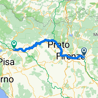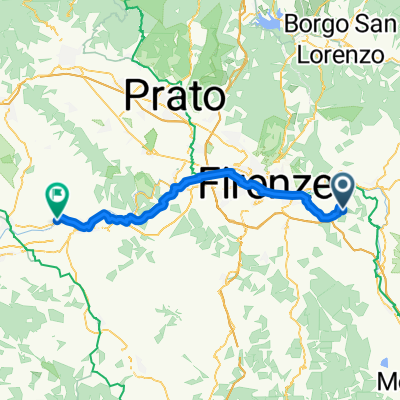
Pontassieve - Marcignana
- 54.9 km
- 502 m
- 881 m
- Pontassieve, Tuscany, Italy
A cycling route starting in Pontassieve, Tuscany, Italy.
Overview
MTB route – 2nd part of the Renaissance loop
It starts from Pontassieve station and almost immediately begins climbing towards Semprugnano. The ride continues along a challenging dirt climb for about 3 km until crossing Via di Castigliomchio. There's a moment to catch your breath at the Castello di Poggio a Luco, then about 2 tough kilometers (fortunately on asphalt) to San Francesco all’Incontro. Now a descent begins, with an initial dirt section, down to San Donato in Collina. Again, a demanding climb of about 2 km leads to the Fontesanta refuge and spring. Then comes a long descent of about 9 km on mixed dirt and asphalt terrain down to the Mulino di Castel Ruggero. About 8 more kilometers, mainly uphill on mixed asphalt/dirt, to reach Impruneta. From there, the route heads toward Galluzzo with a short detour to visit the Certosa. The ride continues mainly on a dirt climb for about 10 km, then begins descending (with just a short ramp) towards Lastra a Signa.
created this 4 years ago
Route quality
Quiet road
30.1 km
(49 %)
Track
12.9 km
(21 %)
Paved
22.1 km
(36 %)
Unpaved
21.5 km
(35 %)
Asphalt
22.1 km
(36 %)
Ground
9.8 km
(16 %)
Continue with Bikemap
You would like to ride Pontassieve-Lastra a Signa_2^ parte Anello Rinascimento or customize it for your own trip? Here is what you can do with this Bikemap route:
Free trial for 3 days, or one-time payment. More about Bikemap Premium.
Discover more Premium features.
Get Bikemap PremiumFrom our community
Open it in the app