
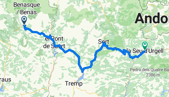
TRANSPIRENAICA 2002 Etap 4-Castejon-Seo Urgell 2/07/2002
A cycling route starting in Castejón de Sos, Aragon, Spain.
Overview
About this route
Towns on the route and profile:
TOWNS Distance (km) Elevation (m) Castejon de Sos 409 904 Coll de Fades 419 1470 Coll de Espina 427 1407 Pont de Suert 446 838 Coll de Perves 467 1350 Senterada 490 838 Pobla de Segur 499 525 Els Collegats 506 565 Sort 527 690 Puerto del Cantó 546 1725 Adrall 573 675 Seo de Urgell 579 690Total: 170 Km
- -:--
- Duration
- 160.5 km
- Distance
- 2,740 m
- Ascent
- 2,998 m
- Descent
- ---
- Avg. speed
- ---
- Max. altitude
Route quality
Waytypes & surfaces along the route
Waytypes
Cycleway
25.7 km
(16 %)
Quiet road
9.6 km
(6 %)
Surfaces
Paved
85.1 km
(53 %)
Asphalt
85.1 km
(53 %)
Undefined
75.5 km
(47 %)
Continue with Bikemap
Use, edit, or download this cycling route
You would like to ride TRANSPIRENAICA 2002 Etap 4-Castejon-Seo Urgell 2/07/2002 or customize it for your own trip? Here is what you can do with this Bikemap route:
Free features
- Save this route as favorite or in collections
- Copy & plan your own version of this route
- Split it into stages to create a multi-day tour
- Sync your route with Garmin or Wahoo
Premium features
Free trial for 3 days, or one-time payment. More about Bikemap Premium.
- Navigate this route on iOS & Android
- Export a GPX / KML file of this route
- Create your custom printout (try it for free)
- Download this route for offline navigation
Discover more Premium features.
Get Bikemap PremiumFrom our community
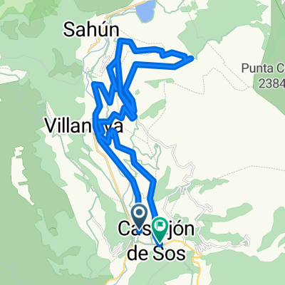
Other popular routes starting in Castejón de Sos
 Cantábrico-Mediterráneo 2014: 5.ª etapa
- Distance
- 134.8 km
- Ascent
- 2,023 m
- Descent
- 2,408 m
- Location
- Castejón de Sos, Aragon, Spain
 ETAPA 10 TRANSPIRENAICA CON ALFORJAS
- Distance
- 57.7 km
- Ascent
- 1,326 m
- Descent
- 1,628 m
- Location
- Castejón de Sos, Aragon, Spain
 QDDA RIBAGORZA
- Distance
- 114.8 km
- Ascent
- 2,235 m
- Descent
- 2,235 m
- Location
- Castejón de Sos, Aragon, Spain
 Magic Line + Laja Flow + Eresue Sesue (Mario L)
- Distance
- 30.8 km
- Ascent
- 1,029 m
- Descent
- 1,015 m
- Location
- Castejón de Sos, Aragon, Spain
 TRACK3.2
- Distance
- 49 km
- Ascent
- 727 m
- Descent
- 1,113 m
- Location
- Castejón de Sos, Aragon, Spain
 PUERTO DE SAHÚN (por Chía)
- Distance
- 16.3 km
- Ascent
- 1,303 m
- Descent
- 199 m
- Location
- Castejón de Sos, Aragon, Spain
 PUERTO de SAHÚN, por Chía
- Distance
- 17 km
- Ascent
- 1,160 m
- Descent
- 48 m
- Location
- Castejón de Sos, Aragon, Spain
 Track 8 Pirineus Backroads 2020
- Distance
- 93.4 km
- Ascent
- 2,263 m
- Descent
- 2,485 m
- Location
- Castejón de Sos, Aragon, Spain
Open it in the app