![[10] OSWIECIM - TENCZYNEK - TRZEBINIA](/_next/static/media/contour-lines-light-small.cafd5e5d.avif)
![[10] OSWIECIM - TENCZYNEK - TRZEBINIA](https://media.bikemap.net/routes/9815195/staticmaps/in_0e5df7b3-bf06-43fa-9cdc-4a8aa6ed34c6_694x400_bikemap-2021-3D-static.png)
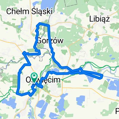
[10] OSWIECIM - TENCZYNEK - TRZEBINIA
A cycling route starting in Oświęcim, Lesser Poland Voivodeship, Poland.
Overview
About this route
FROM THE BESKIDS TO MAŁOPOLSKA | Partially marked cycling route initially leading from Bielsko-Biała to Czechowice-Dziedzice, then following the Vistula Cycling Route through Brzeszcze, Oświęcim to Okleśna and further through the Rudno Stream Valley Nature Reserve, the castle ruins in Tenczynek, and the Dulowska Forest to the finish in Trzebinia.
- -:--
- Duration
- 62.8 km
- Distance
- 211 m
- Ascent
- 153 m
- Descent
- ---
- Avg. speed
- 333 m
- Max. altitude

Route quality
Waytypes & surfaces along the route
Waytypes
Cycleway
21.4 km
(34 %)
Track
16.3 km
(26 %)
Surfaces
Paved
46.5 km
(74 %)
Unpaved
13.2 km
(21 %)
Asphalt
42.7 km
(68 %)
Gravel
5.7 km
(9 %)
Continue with Bikemap
Use, edit, or download this cycling route
You would like to ride [10] OSWIECIM - TENCZYNEK - TRZEBINIA or customize it for your own trip? Here is what you can do with this Bikemap route:
Free features
- Save this route as favorite or in collections
- Copy & plan your own version of this route
- Sync your route with Garmin or Wahoo
Premium features
Free trial for 3 days, or one-time payment. More about Bikemap Premium.
- Navigate this route on iOS & Android
- Export a GPX / KML file of this route
- Create your custom printout (try it for free)
- Download this route for offline navigation
Discover more Premium features.
Get Bikemap PremiumFrom our community
Other popular routes starting in Oświęcim
 Wtr Wisła oświęcim
- Distance
- 92.6 km
- Ascent
- 333 m
- Descent
- 44 m
- Location
- Oświęcim, Lesser Poland Voivodeship, Poland
 Oswiecim to Krakow
- Distance
- 86.1 km
- Ascent
- 154 m
- Descent
- 171 m
- Location
- Oświęcim, Lesser Poland Voivodeship, Poland
 WTR 44km
- Distance
- 45.9 km
- Ascent
- 45 m
- Descent
- 45 m
- Location
- Oświęcim, Lesser Poland Voivodeship, Poland
 Łukasza Górnickiego 5, Oświęcim to S Klimeckiego 24, Kraków
- Distance
- 83.2 km
- Ascent
- 160 m
- Descent
- 202 m
- Location
- Oświęcim, Lesser Poland Voivodeship, Poland
 prom Oświęcim - Krk
- Distance
- 82.9 km
- Ascent
- 36 m
- Descent
- 66 m
- Location
- Oświęcim, Lesser Poland Voivodeship, Poland
 mdylski1
- Distance
- 39.4 km
- Ascent
- 33 m
- Descent
- 33 m
- Location
- Oświęcim, Lesser Poland Voivodeship, Poland
 Oświęcim - okolice Pszczyny
- Distance
- 42.1 km
- Ascent
- 70 m
- Descent
- 72 m
- Location
- Oświęcim, Lesser Poland Voivodeship, Poland
 Tour de Pologne 2011 Stage 4
- Distance
- 142.4 km
- Ascent
- 1,151 m
- Descent
- 1,045 m
- Location
- Oświęcim, Lesser Poland Voivodeship, Poland
Open it in the app