

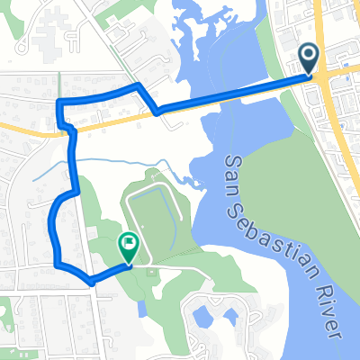
Los Robles Avenue 1461, St. Augustine to Saint Augustine Boulevard 2640, St. Augustine
A cycling route starting in Saint Augustine, Florida, United States.
Overview
About this route
- 4 h 37 min
- Duration
- 17.7 km
- Distance
- 16 m
- Ascent
- 7 m
- Descent
- 3.8 km/h
- Avg. speed
- ---
- Max. altitude

Continue with Bikemap
Use, edit, or download this cycling route
You would like to ride Los Robles Avenue 1461, St. Augustine to Saint Augustine Boulevard 2640, St. Augustine or customize it for your own trip? Here is what you can do with this Bikemap route:
Free features
- Save this route as favorite or in collections
- Copy & plan your own version of this route
- Sync your route with Garmin or Wahoo
Premium features
Free trial for 3 days, or one-time payment. More about Bikemap Premium.
- Navigate this route on iOS & Android
- Export a GPX / KML file of this route
- Create your custom printout (try it for free)
- Download this route for offline navigation
Discover more Premium features.
Get Bikemap PremiumFrom our community
Other popular routes starting in Saint Augustine
 Castillo De San Marcos;Vilano; Freedom Park and Back
- Distance
- 17.3 km
- Ascent
- 48 m
- Descent
- 46 m
- Location
- Saint Augustine, Florida, United States
 Arapaho Ave, St. Augustine to Shipyard Way, St. Augustine
- Distance
- 3.2 km
- Ascent
- 23 m
- Descent
- 31 m
- Location
- Saint Augustine, Florida, United States
 Saragossa Street 23, St. Augustine to Southwest 1st Street 70, Lake Butler
- Distance
- 138.9 km
- Ascent
- 424 m
- Descent
- 387 m
- Location
- Saint Augustine, Florida, United States
 To Downtown
- Distance
- 2.4 km
- Ascent
- 12 m
- Descent
- 12 m
- Location
- Saint Augustine, Florida, United States
 US 4
US 4- Distance
- 169.2 km
- Ascent
- 68 m
- Descent
- 66 m
- Location
- Saint Augustine, Florida, United States
 Los Robles Avenue 1461, St. Augustine to Saint Augustine Boulevard 2640, St. Augustine
- Distance
- 17.7 km
- Ascent
- 16 m
- Descent
- 7 m
- Location
- Saint Augustine, Florida, United States
 Route to Joe Pomar Park
- Distance
- 2.4 km
- Ascent
- 7 m
- Descent
- 4 m
- Location
- Saint Augustine, Florida, United States
 ASW 6-6-2021
- Distance
- 11.3 km
- Ascent
- 30 m
- Descent
- 28 m
- Location
- Saint Augustine, Florida, United States
Open it in the app