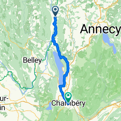
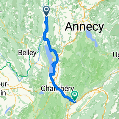
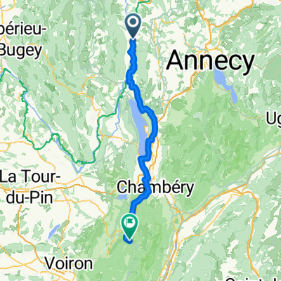
COL DE LA BICHE (por Corbonod)
A cycling route starting in Versonnex, Auvergne-Rh么ne-Alpes, France.
Overview
About this route
- -:--
- Duration
- 15.6 km
- Distance
- 1,149 m
- Ascent
- 86 m
- Descent
- ---
- Avg. speed
- 1,324 m
- Avg. speed
Route quality
Waytypes & surfaces along the route
Waytypes
Road
12.9 km
(83 %)
Busy road
2.3 km
(15 %)
Surfaces
Paved
1.2 km
(8 %)
Unpaved
0.4 km
(2 %)
Asphalt
1.2 km
(8 %)
Gravel
0.4 km
(2 %)
Undefined
14 km
(90 %)
Continue with Bikemap
Use, edit, or download this cycling route
You would like to ride COL DE LA BICHE (por Corbonod) or customize it for your own trip? Here is what you can do with this Bikemap route:
Free features
- Save this route as favorite or in collections
- Copy & plan your own version of this route
- Sync your route with Garmin or Wahoo
Premium features
Free trial for 3 days, or one-time payment. More about Bikemap Premium.
- Navigate this route on iOS & Android
- Export a GPX / KML file of this route
- Create your custom printout (try it for free)
- Download this route for offline navigation
Discover more Premium features.
Get Bikemap PremiumFrom our community
Other popular routes starting in Versonnex
- 茅tape 3 jours 1
- Distance
- 35.2 km
- Ascent
- 214 m
- Descent
- 235 m
- Location
- Versonnex, Auvergne-Rh么ne-Alpes, France
- von Genf nach Lyon - Tag 3 - von Seyssel nach Belley
- Distance
- 36.5 km
- Ascent
- 267 m
- Descent
- 246 m
- Location
- Versonnex, Auvergne-Rh么ne-Alpes, France
- Via Rhona Seyssel/Chanaz/Belley
- Distance
- 33.2 km
- Ascent
- 81 m
- Descent
- 103 m
- Location
- Versonnex, Auvergne-Rh么ne-Alpes, France
- Le Tour du Chat
- Distance
- 85.1 km
- Ascent
- 608 m
- Descent
- 610 m
- Location
- Versonnex, Auvergne-Rh么ne-Alpes, France
- Tour du lac du Bourget (89km)
- Distance
- 89.3 km
- Ascent
- 1,656 m
- Descent
- 1,657 m
- Location
- Versonnex, Auvergne-Rh么ne-Alpes, France
- VR08 Seyssel-Champagneux.kml - VR08 Seyssel-Champagneux.kml_VR08 Seyssel-Champagneux
- Distance
- 54 km
- Ascent
- 262 m
- Descent
- 311 m
- Location
- Versonnex, Auvergne-Rh么ne-Alpes, France
- GTJG 5 NOK_Seyssel-Cluses
- Distance
- 103.4 km
- Ascent
- 3,818 m
- Descent
- 3,583 m
- Location
- Versonnex, Auvergne-Rh么ne-Alpes, France
- J-2: Back sur la Via Rhona
- Distance
- 83 km
- Ascent
- 149 m
- Descent
- 198 m
- Location
- Versonnex, Auvergne-Rh么ne-Alpes, France
Open it in the app