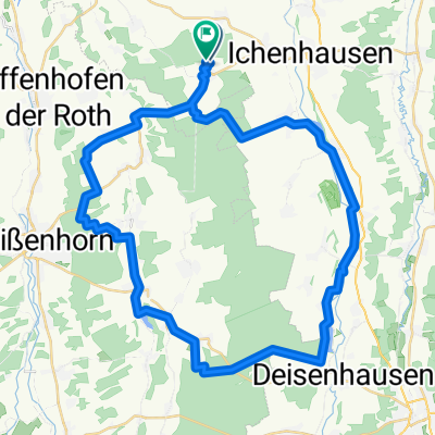
Autenried-Wasserberg-Burg-Autenried Gravel

A cycling route starting in Rieden an der Kötz, Bavaria, Germany.
OverviewAbout this route

Die Runde hat 84 Km und nicht die hier berechneten 96 Km.

Die Höhenmeter stimmen ziemlich genau. 

Zwischen  Waltenhausen  und Aletshausen ist ein Stück

Kiesweg im Wald , mit einem Gravelbike kein Problem. 

-:--
Duration
96.5 km
Distance
473 m
Ascent
471 m
Descent
---
Avg. speed
591 m
Max. altitude
Mikecreated this 4 years ago
Route qualityWaytypes & surfaces along the route
Waytypes
  • Road

    35.7 km37 %
  • Path

    29.9 km31 %
  • Quiet road

    15.4 km16 %
Surfaces

Paved

85.9 km(89 %)

Unpaved

3.9 km(4 %)
  • Asphalt

    77.2 km80 %
  • Paved (undefined)

    8.7 km9 %
  • Gravel

    1.9 km2 %
Continue with BikemapUse, edit, or download this cycling route
You would like to ride Autenried-Wasserberg-Burg-Autenried Gravel or customize it for your own trip? Here is what you can do with this Bikemap route:
Free features
Premium features

Free trial for 3 days, or one-time payment. More about Bikemap Premium.

  • Navigate this route on iOS & Android
  • Export a GPX / KML file of this route
  • Create your custom printout (try it for free)
  • Download this route for offline navigation

Discover more Premium features.

Get Bikemap Premium
From our communityOther popular routes starting in Rieden an der Kötz

Open it in the app