

Borstendorf-Lengefeld-Pockau-Lauterbach
A cycling route starting in Grünhainichen, Saxony, Germany.
Overview
About this route
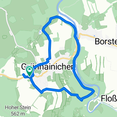
Short but hilly evening ride with 43 km and 979 m of elevation gain according to the bike computer.
- -:--
- Duration
- 43.4 km
- Distance
- 850 m
- Ascent
- 842 m
- Descent
- ---
- Avg. speed
- ---
- Max. altitude

Continue with Bikemap
Use, edit, or download this cycling route
You would like to ride Borstendorf-Lengefeld-Pockau-Lauterbach or customize it for your own trip? Here is what you can do with this Bikemap route:
Free features
- Save this route as favorite or in collections
- Copy & plan your own version of this route
- Sync your route with Garmin or Wahoo
Premium features
Free trial for 3 days, or one-time payment. More about Bikemap Premium.
- Navigate this route on iOS & Android
- Export a GPX / KML file of this route
- Create your custom printout (try it for free)
- Download this route for offline navigation
Discover more Premium features.
Get Bikemap PremiumFrom our community
Other popular routes starting in Grünhainichen
 Borstendorf-Lengefeld-Pockau-Lauterbach
- Distance
- 43.4 km
- Ascent
- 850 m
- Descent
- 842 m
- Location
- Grünhainichen, Saxony, Germany
 Rundweg Flöhatal-Bornwald
- Distance
- 28.6 km
- Ascent
- 581 m
- Descent
- 484 m
- Location
- Grünhainichen, Saxony, Germany
 SachsenDreier
- Distance
- 293.9 km
- Ascent
- 797 m
- Descent
- 824 m
- Location
- Grünhainichen, Saxony, Germany
 Zum Sauensäger
- Distance
- 64 km
- Ascent
- 708 m
- Descent
- 708 m
- Location
- Grünhainichen, Saxony, Germany
 Borstendorf_Großwaltersdorf_Talstraße
- Distance
- 30.7 km
- Ascent
- 424 m
- Descent
- 458 m
- Location
- Grünhainichen, Saxony, Germany
 Kleine Tour
- Distance
- 27.3 km
- Ascent
- 327 m
- Descent
- 457 m
- Location
- Grünhainichen, Saxony, Germany
 Borstendorf-Marbach-Bornwald-Neunzehnhainer
- Distance
- 39.6 km
- Ascent
- 581 m
- Descent
- 573 m
- Location
- Grünhainichen, Saxony, Germany
 Am Wasserwerk 1, Grünhainichen nach Am Sportplatz 1, Grünhainichen
- Distance
- 7.2 km
- Ascent
- 152 m
- Descent
- 157 m
- Location
- Grünhainichen, Saxony, Germany
Open it in the app