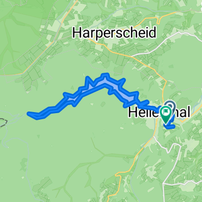
Hellenthal
A cycling route starting in Hellenthal, North Rhine-Westphalia, Germany.
Overview
About this route
Van Hardtstraße, 53940 Hellenthal, Noordrijn-Westfalen, Duitsland Naar Hardtstraße, 53940 Hellenthal, Noordrijn-Westfalen, Duitsland Routering Recreatief fietsen - mooiste
- -:--
- Duration
- 75.2 km
- Distance
- 1,419 m
- Ascent
- 1,416 m
- Descent
- ---
- Avg. speed
- ---
- Avg. speed
Route quality
Waytypes & surfaces along the route
Waytypes
Track
37.9 km
(50 %)
Cycleway
13.4 km
(18 %)
Surfaces
Paved
51.3 km
(68 %)
Unpaved
15.3 km
(20 %)
Asphalt
39.6 km
(53 %)
Gravel
10.2 km
(14 %)
Continue with Bikemap
Use, edit, or download this cycling route
You would like to ride Hellenthal or customize it for your own trip? Here is what you can do with this Bikemap route:
Free features
- Save this route as favorite or in collections
- Copy & plan your own version of this route
- Sync your route with Garmin or Wahoo
Premium features
Free trial for 3 days, or one-time payment. More about Bikemap Premium.
- Navigate this route on iOS & Android
- Export a GPX / KML file of this route
- Create your custom printout (try it for free)
- Download this route for offline navigation
Discover more Premium features.
Get Bikemap PremiumFrom our community
Other popular routes starting in Hellenthal
- Große Runde mit Gegenwind
- Distance
- 85.6 km
- Ascent
- 644 m
- Descent
- 644 m
- Location
- Hellenthal, North Rhine-Westphalia, Germany
- Hollerath
- Distance
- 110 km
- Ascent
- 882 m
- Descent
- 882 m
- Location
- Hellenthal, North Rhine-Westphalia, Germany
- tour6
- Distance
- 33.2 km
- Ascent
- 657 m
- Descent
- 654 m
- Location
- Hellenthal, North Rhine-Westphalia, Germany
- Jan De Laet Fietsweekend Kris 201906 Maandag
- Distance
- 57 km
- Ascent
- 530 m
- Descent
- 861 m
- Location
- Hellenthal, North Rhine-Westphalia, Germany
- 2025 Tag 8 Hellenthal-Waldfeucht
- Distance
- 101.6 km
- Ascent
- 625 m
- Descent
- 1,005 m
- Location
- Hellenthal, North Rhine-Westphalia, Germany
- Hellenthal Ländchen Kall
- Distance
- 37 km
- Ascent
- 555 m
- Descent
- 555 m
- Location
- Hellenthal, North Rhine-Westphalia, Germany
- EifelSpur Westwall (Gemeinde Hellenthal)
- Distance
- 13.1 km
- Ascent
- 244 m
- Descent
- 241 m
- Location
- Hellenthal, North Rhine-Westphalia, Germany
- 2020 Runde um Olefstausee
- Distance
- 19.4 km
- Ascent
- 308 m
- Descent
- 281 m
- Location
- Hellenthal, North Rhine-Westphalia, Germany
Open it in the app