

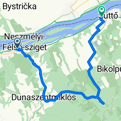
Moča - Kravany - Mužla - Búč - Moča
A cycling route starting in Neszmély, Komárom-Esztergom, Hungary.
Overview
About this route
- 2 h 3 min
- Duration
- 40.3 km
- Distance
- 86 m
- Ascent
- 87 m
- Descent
- 19.6 km/h
- Avg. speed
- ---
- Max. altitude

Route photos

Route quality
Waytypes & surfaces along the route
Waytypes
Cycleway
12.9 km
(32 %)
Road
11.7 km
(29 %)
Surfaces
Paved
17.7 km
(44 %)
Unpaved
2 km
(5 %)
Asphalt
17.7 km
(44 %)
Ground
1.2 km
(3 %)
Continue with Bikemap
Use, edit, or download this cycling route
You would like to ride Moča - Kravany - Mužla - Búč - Moča or customize it for your own trip? Here is what you can do with this Bikemap route:
Free features
- Save this route as favorite or in collections
- Copy & plan your own version of this route
- Sync your route with Garmin or Wahoo
Premium features
Free trial for 3 days, or one-time payment. More about Bikemap Premium.
- Navigate this route on iOS & Android
- Export a GPX / KML file of this route
- Create your custom printout (try it for free)
- Download this route for offline navigation
Discover more Premium features.
Get Bikemap PremiumFrom our community
Other popular routes starting in Neszmély
 Hilltop Borhotel-Tata-Tatabánya(Turul)
- Distance
- 26.3 km
- Ascent
- 246 m
- Descent
- 195 m
- Location
- Neszmély, Komárom-Esztergom, Hungary
 Mérsékelt útvonal
- Distance
- 3.4 km
- Ascent
- 0 m
- Descent
- 7 m
- Location
- Neszmély, Komárom-Esztergom, Hungary
 Hilltop HU - KN
- Distance
- 26.2 km
- Ascent
- 40 m
- Descent
- 191 m
- Location
- Neszmély, Komárom-Esztergom, Hungary
 Budapest-Neszmély-Etyek-Budapest 2. nap
- Distance
- 61.7 km
- Ascent
- 414 m
- Descent
- 488 m
- Location
- Neszmély, Komárom-Esztergom, Hungary
 20 km vasut
- Distance
- 17.6 km
- Ascent
- 477 m
- Descent
- 475 m
- Location
- Neszmély, Komárom-Esztergom, Hungary
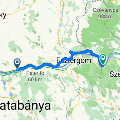
 Esztergom - Neszmély - Esztergom kerékpárúton
- Distance
- 77 km
- Ascent
- 266 m
- Descent
- 265 m
- Location
- Neszmély, Komárom-Esztergom, Hungary
 MOČA - KRAVANY - MOČA
- Distance
- 24.2 km
- Ascent
- 20 m
- Descent
- 22 m
- Location
- Neszmély, Komárom-Esztergom, Hungary
 Neszmély - Nagymaros
- Distance
- 60.3 km
- Ascent
- 126 m
- Descent
- 131 m
- Location
- Neszmély, Komárom-Esztergom, Hungary
Open it in the app