

2 days off
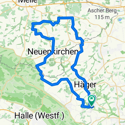
A cycling route starting in Werther, North Rhine-Westphalia, Germany.
Overview
About this route
- -:--
- Duration
- 73.7 km
- Distance
- 374 m
- Ascent
- 383 m
- Descent
- ---
- Avg. speed
- 215 m
- Max. altitude

Route quality
Waytypes & surfaces along the route
Waytypes
Quiet road
24.7 km
(34 %)
Path
21.6 km
(29 %)
Surfaces
Paved
67.4 km
(91 %)
Unpaved
0.8 km
(1 %)
Asphalt
55.4 km
(75 %)
Paving stones
11.6 km
(16 %)
Continue with Bikemap
Use, edit, or download this cycling route
You would like to ride 2 days off or customize it for your own trip? Here is what you can do with this Bikemap route:
Free features
- Save this route as favorite or in collections
- Copy & plan your own version of this route
- Sync your route with Garmin or Wahoo
Premium features
Free trial for 3 days, or one-time payment. More about Bikemap Premium.
- Navigate this route on iOS & Android
- Export a GPX / KML file of this route
- Create your custom printout (try it for free)
- Download this route for offline navigation
Discover more Premium features.
Get Bikemap PremiumFrom our community
Other popular routes starting in Werther
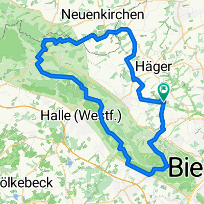
 Beautifil Road from Halle to Bielefeld
- Distance
- 10.8 km
- Ascent
- 297 m
- Descent
- 330 m
- Location
- Werther, North Rhine-Westphalia, Germany
 Nachtradeln Bifurkation-Else-Werre mit Anfahrt und wieder zurück nach Deppendorf (Bielefeld)
- Distance
- 123.6 km
- Ascent
- 370 m
- Descent
- 370 m
- Location
- Werther, North Rhine-Westphalia, Germany
 1. sonnige Ausfahrt 2008
- Distance
- 42.9 km
- Ascent
- 263 m
- Descent
- 243 m
- Location
- Werther, North Rhine-Westphalia, Germany
 Frühlingsrunde am 31.3.2009
- Distance
- 44.5 km
- Ascent
- 255 m
- Descent
- 245 m
- Location
- Werther, North Rhine-Westphalia, Germany
 Dornberg-Neuenkirchen und zurück
- Distance
- 34.7 km
- Ascent
- 239 m
- Descent
- 241 m
- Location
- Werther, North Rhine-Westphalia, Germany
 Berg- und Talfahrt im Teutoburger Wald
- Distance
- 46.7 km
- Ascent
- 615 m
- Descent
- 610 m
- Location
- Werther, North Rhine-Westphalia, Germany
 Ascheloh-bRothenfelde-uz 42km
- Distance
- 42 km
- Ascent
- 239 m
- Descent
- 230 m
- Location
- Werther, North Rhine-Westphalia, Germany
 2008/09_Von Häger zum Beutling
- Distance
- 38.3 km
- Ascent
- 434 m
- Descent
- 434 m
- Location
- Werther, North Rhine-Westphalia, Germany
Open it in the app